Condition Report
Contact Information
Lot 98
Sale 6465 - Printed and Manuscript Americana
Jan 29, 2026
10:00AM ET
Live / Philadelphia
Own a similar item?
Estimate
$35,000 -
50,000
Price Realized
$48,000
Sold prices are inclusive of Buyer’s Premium
Lot Description
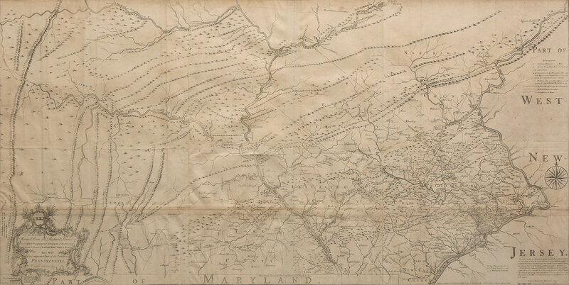
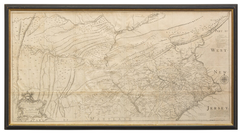
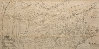
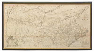
[Maps & Atlases] [Pennsylvania] Scull, Nicholas. To the Honourable Thomas Penn and Richard Penn Esqrs. True & absolute Proprietaries & Governours of the Province of Pennsylvania & Counties of New-Castle Kent & Sussex on Delaware This Map Of the improved Part of the Province of Pennsylvania...
"The first map of Pennsylvania to be published in America [and] the most ambitious cartographical work to come from an American source before the Revolution." (Wroth)
Philadelphia: Engraved by Jas. Turner, and Printed by John Davis, for the Author, January 1, 1759. Engraved map on six joined sheets. First state (before the addition of text at Nelson's Ferry and the additional road running directly east from Carlisle to Pine Ford). Scattered wear along edges and folds. 61 x 30 1/2 in. (1,549 x 775 mm). In frame, 34 1/2 x 64 in. (876 x 1,626 mm). Evans 8489; Eberstadt 167:430 (quoting Wroth); Garrison, "Cartography of Pennsylvania before 1800", in Pennsylvania Magazine of History and Bibliography, Vol. 59, no. 3; Phillips (Maps), p. 673; Ristow, pp. 52-53; Sellers & Van Ee 1294.0; Streeter Sale 965; Wheat & Brun 422
Nicholas Scull, Jr. (1687-1761) was born in Philadelphia to Nicholas Scull, Sr., the surveyor and mapmaker, who had been apprenticed to William Penn's surveyor, Thomas Holme. In 1719, Scull, Jr., became deputy surveyor of Philadelphia County, eventually ascending to the Surveyor Generalship of Pennsylvania, in 1748. A bibliophile, he was an original member of Benjamin Franklin's Junto. Intimately involved with Native American relations for the colony, Scull travelled amongst the various tribes to survey the western counties. This is the first map of Pennsylvania since Holme's 1687 map of the then much smaller settlement, and represents a vast amount of on-site surveying. Dedicated to the Penn brothers, it is among the largest and finest maps produced in America in the 18th century.
Scull's map depicts Philadelphia, Bucks, Northampton, Berks, Chester, Lancaster, Cumberland, and York counties, and is based on Scull's own surveys, as well as from other contributions. Some information was gleaned from printed sources, including Jefferson and Fry's important map. Largely accurate and highly detailed, the map depicts a wealth of landmarks, including churches, meeting houses, inns, iron forges, mills, manors of significant residents, various roads, Indian paths, Indian towns and forts, and much more.
Scull's map is very rare, with less than a dozen known institutional copies. Furthermore, in the past half century, only a small few have appeared at auction.
A handsome example.
This lot is located in Philadelphia.