
Condition Report
Contact Information
Lot 99
Sale 6465 - Printed and Manuscript Americana
Jan 29, 2026
10:00AM ET
Live / Philadelphia
Own a similar item?
Estimate
$2,500 -
3,500
Price Realized
$3,200
Sold prices are inclusive of Buyer’s Premium
Lot Description
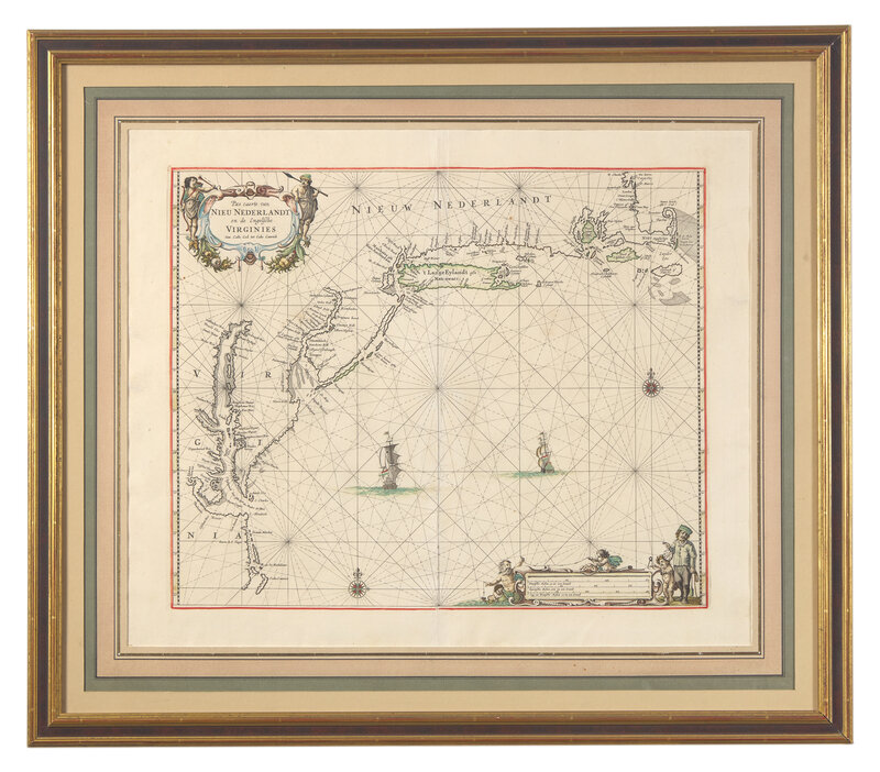
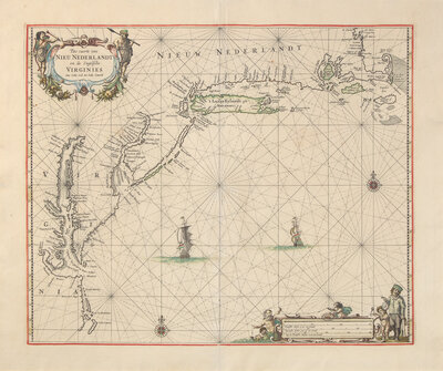
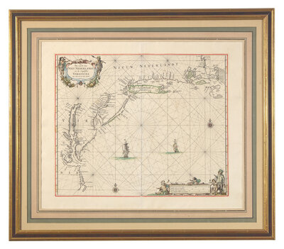
[Maps & Atlases] (Goos, Pieter). Pas caerte van Nieu Nederlandt en de Engelsche Virginies van Cabo Cod tot Cabo Canrick
(Amsterdam, 1666). Engraved map with period outline hand-coloring. 21 1/4 x 24 1/2 in. (540 x 622 mm). In mat and in frame, 27 1/2 x 31 1/2 in. (698 x 800 mm). Burden 387; Deak 48
A lovely example of one of the finest 17th-century maps of the Northeast of America, from Pieter Goos's atlas, De Zee Atlas ofter Water-Weereld. Depicting the Atlantic coast, from Cape Cod in the north to Cape Hatteras in the South, Goos's map emphasizes the Dutch colony of New Netherland, with New Amsterdam (now New York City) shown at the tip of Manhattan. Numerous Dutch settlements are shown, including "Staten Eylandt," "Lange Iylandt," Fort Casimir, Nassau, and Elsenburgh. Swedish settlements are also noted, including Fort Christina. The various settlements along the Schuylkill River are shown, including the future site of Philadelphia, which would be founded 16 years hence by William Penn. Other locations noted include Martha's Vineyard and Nantucket, as well as the English settlements of New Plymouth and Jamestown.
This lot is located in Philadelphia.