
Condition Report
Contact Information
Auction Specialist
Lot 226
Sale 6330 - Fine Printed Books & Manuscripts, Including Americana
May 8, 2025
10:00AM CT
Live / Chicago
Own a similar item?
Estimate
$2,000 -
3,000
Price Realized
$2,048
Sold prices are inclusive of Buyer’s Premium
Lot Description
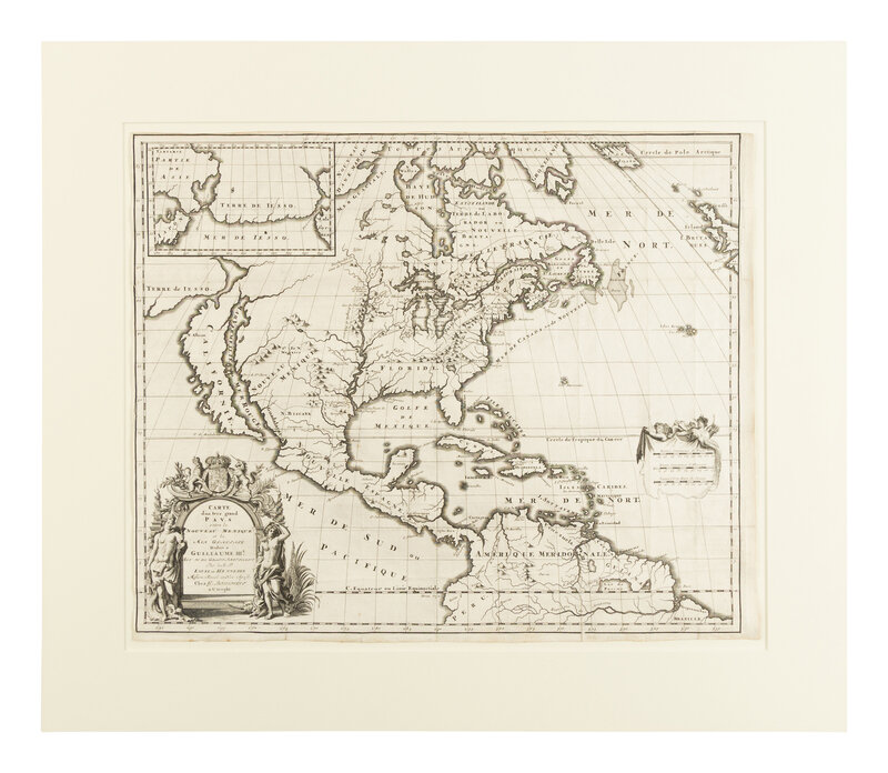
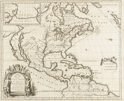
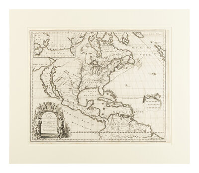
[MAP]. HENNEPIN, Louis (1626-1704). Carte d'un tres grand pays entre le Nouveau Mexique et la Mer Glaciale. Utrecht: G. Broedelet, 1697.
Engraved map, 432 x 533 mm. Ornate title cartouche flanked by two Native Americans and surmounted with the arms of King William III, inset map of the Land of Eso and part of California. (Old folds with few small repairs verso, a couple margins trimmed close, remnants of hinges on verso.)
FIRST STATE, bearing the imprint of G. Broedelet.
One of the two engraved maps (see next lot) published in Hennepin's 1697 Nouvelle Decouverte d'un tres grand pays situe dans l'Amerique. The map depicts a very accurate longitudinal alignment of Florida, the Great Lakes, and Hudson Bay. Several original studies have been applied, such as the Missouri River draining the lake that once fed the Rio de Norte into the Gulf of California, and the northern tip of California the "island" appears conjoined to the mainland. Burden 738.
Property from the Estate of James G. Hansen at Fetcher House, Winnetka, Illinois