Condition Report
Contact Information
Lot 1085
Sale 961 - American Historical Ephemera & Photography
Nov 30, 2021
10:00AM ET
Online / Cincinnati
Own a similar item?
Estimate
$200 -
400
Price Realized
$156
Sold prices are inclusive of Buyer’s Premium
Lot Description
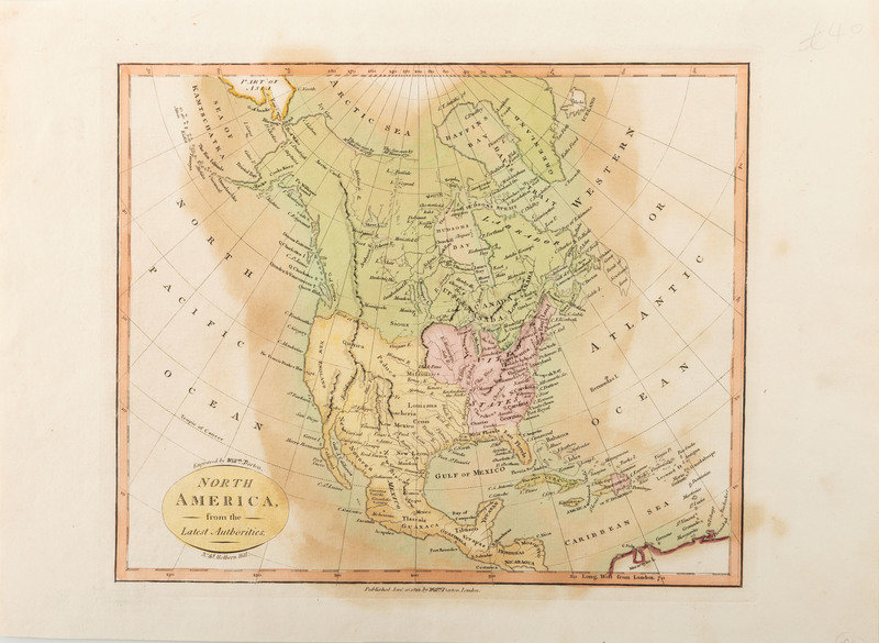
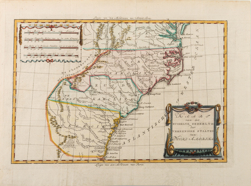
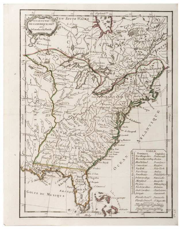
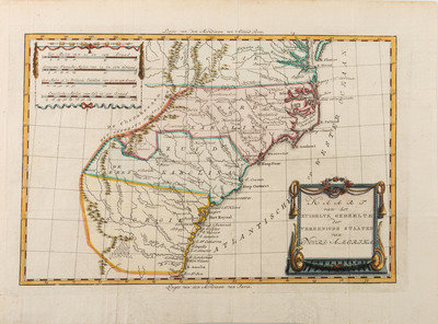
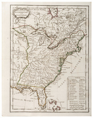
[MAPS]. A group of 3 maps of North America.
Etats-Unis de L'Amerique Seple. avec le Canada et la Florida. 8-1/4 x 10-1/2 in. Limited hand-colored outlines of eastern states. N.p., n.d. [ca 1780s] Includes list of states and their capitals.
KAART ran het Zuidelyk Gedeelte der Vereenicde Staaten ran NOORD AMERIKA. Bachiene, Willem Albert. Atlas tot Opheldering der Hedendaagsche Historie. Amsterdam, M. Schalekamp, 1785. 10-3/4 x 14-3/4 in. Hand-colored. Virginia to Georgia. The only note west of the Appalachians is that it is Cherokee-land.
North America from the Latest Authorities. London: Wm. Darton, 1812. 11 x 15 in. overall. hand-colored. Rare version. The 1814 map with puzzle pieces outlined appears to be more common.