


Condition Report
Contact Information
Lot 304
Sale 945 - Fine Printed Books & Manuscripts, Including Americana
Lots 1-307
Nov 9, 2021
4:00AM CT
Lots 308-687
Nov 10, 2021
4:00AM CT
Live / Chicago
Own a similar item?
Estimate
$2,000 -
3,000
Price Realized
$4,688
Sold prices are inclusive of Buyer’s Premium
Lot Description
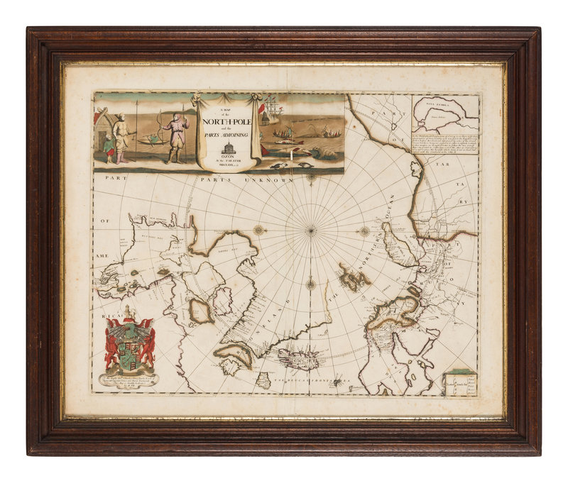
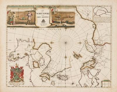
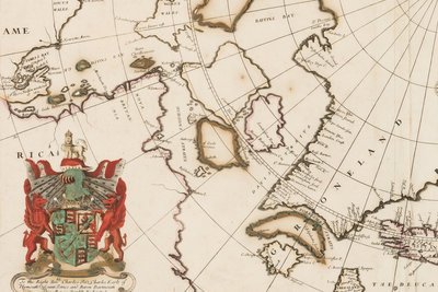
PITT, Moses (1654-1696). A Map of the North-Pole and the Parts Adjoining. Oxford, 1680 (or later).
Engraved map of the North Pole with hand-coloring in wash and outline, 525 x 653 mm visible area, matted and framed (unexamined out of frame). Inset map of Nova Zembla, inset whaling vignette, dedicatory cartouche with coat of arms. (Some minor burn-through of pigment, some minor soiling.)
Prepared by Pitt for The English Atlas, this map "is one of the most evocative of the region ever published" (Burden). "This decorative map combines the primitive concepts of 'Frisland,' 'Frobisher Strait' as bisecting southern Greenland; and the three-island concept of Arctic Canada introduced by Sanson" (Kershaw). Burden II, 525; Kershaw 120.