Condition Report
Contact Information
Lot 303
Sale 945 - Fine Printed Books & Manuscripts, Including Americana
Lots 1-307
Nov 9, 2021
4:00AM CT
Lots 308-687
Nov 10, 2021
4:00AM CT
Live / Chicago
Own a similar item?
Estimate
$400 -
600
Price Realized
$313
Sold prices are inclusive of Buyer’s Premium
Lot Description
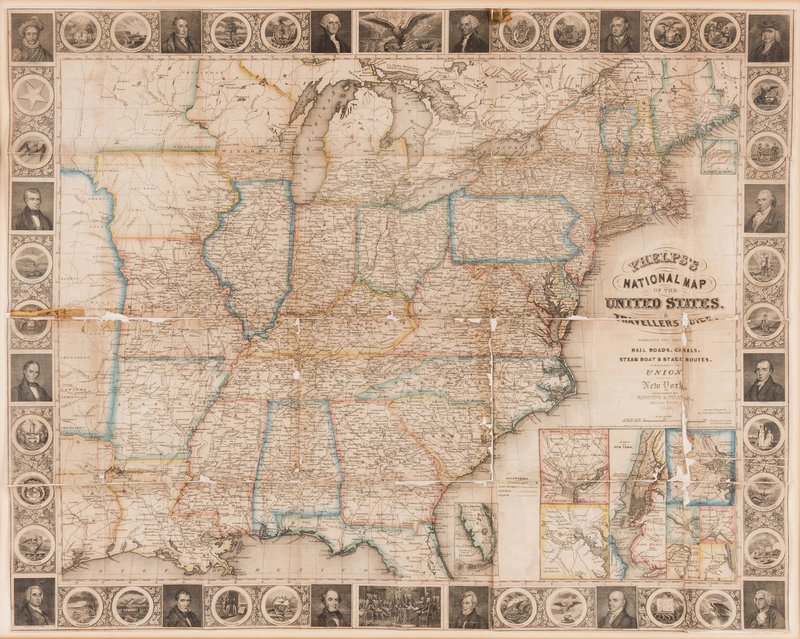
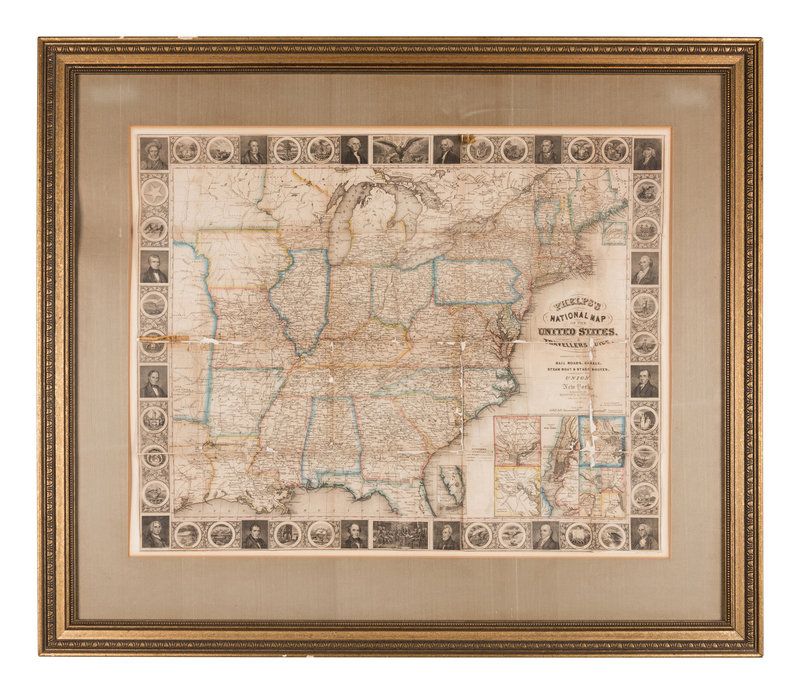
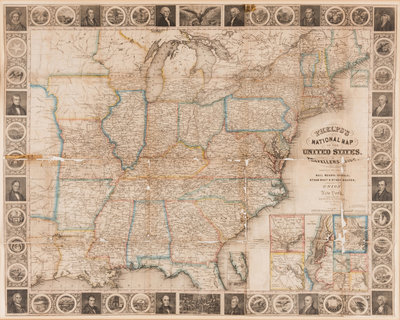
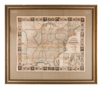
PHELPS, ENSIGNS & THAYER, publishers. Phelps's National Map of the United States, A Travellers Guide [map only]. New York, 1848.
Steel-engraved wall map of the United States on 5 sheets hand-colored in outline, 532 x 822 mm visible area, matted and framed (unexamined out of frame). Map within pictorial borders, inset plans of Washington D. C., New York, Baltimore, Boston, Birmingham, Cincinnati, St. Louis, and Chicago. (Separations with minor losses along folds repaired verso, map backed with linen, some overall browning.)
Second edition, without the large inset map of Oregon, California and Texas which would appear in later editions. Pictorial borders include images of the seals of 30 states including Texas (but not California), and several Presidential portraits. Border vignettes depict the Great Seal of the United States and the signing of the Declaration of Independence. The map extends just past the Mississippi river into the Great Plains, and includes part of Texas and two unnamed regions extending north.
Property from the Collection of Helena Szepe, Tampa, Florida