
Condition Report
Contact Information
Lot 281
Sale 6426 - Fine Printed Books & Manuscripts, Including Americana
Nov 13, 2025
10:00AM CT
Live / Chicago
Own a similar item?
Estimate
$600 -
800
Price Realized
$832
Sold prices are inclusive of Buyer’s Premium
Lot Description
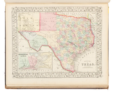
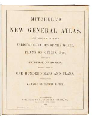
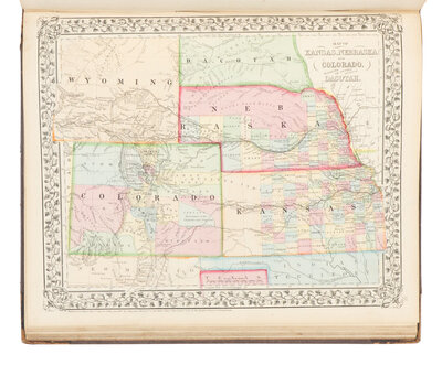
MITCHELL, Samuel Augustus (1792-1868). Mitchell’s New General Atlas Containing Maps of the Various Countries of the World, Plans of Cities, etc. Philadelphia: S. Augustus Mitchell, 1869.
Folio. 58 hand-colored lithographed maps (6 double-page), containing 96 maps and plans (the insets numbered as separate subjects), 42 relating to the Americas. (Occasional spotting, mostly concentrated to preliminaries, light marginal soiling.) Original half black calf, covers decorated in blind, upper cover lettered in gilt (old touch-ups along spine, fore-corners rubbed, some edgewear).
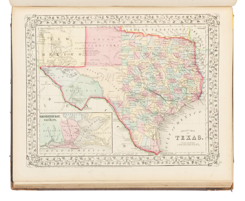
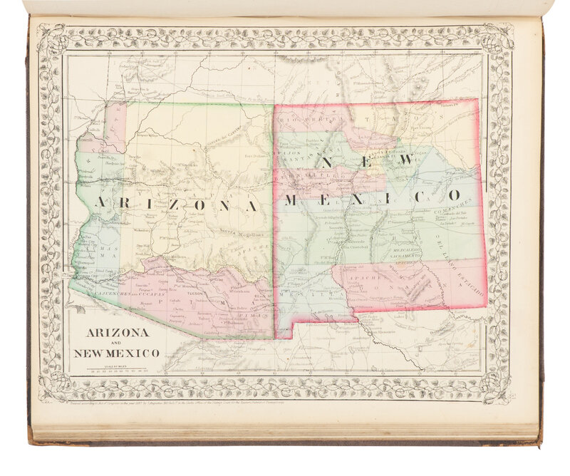
Showing the Territory of Arizona with the borders known today, but with only four counties plus the nebulous political region of Pahute in the northwest corner; modern-day Oklahoma is labeled “Indian Territory”; Northern Texas is still Young Territory, and West Texas is marked with the Llano Estacado or Staked Plains, which were one of the largest mesas in North America. cf. Phillips, Atlases, 859.
This lot is located in Chicago.