


Condition Report
Contact Information
Auction Specialist
Lot 231
Sale 6330 - Fine Printed Books & Manuscripts, Including Americana
May 8, 2025
10:00AM CT
Live / Chicago
Own a similar item?
Estimate
$2,000 -
3,000
Price Realized
$3,520
Sold prices are inclusive of Buyer’s Premium
Lot Description
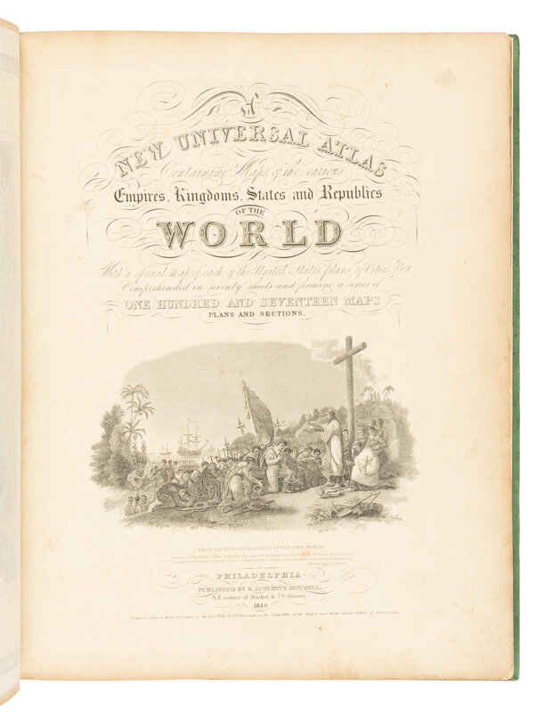
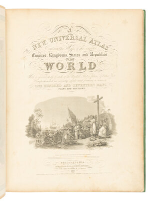
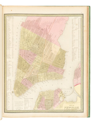
[MAPS & ATLASES]. MITCHELL, Samuel Augustus (1792-1868). A New Universal Atlas Containing Maps of the various Empires, Kingdoms, States and Republics of the World. Philadelphia: S. Augustus Mitchell, 1849.
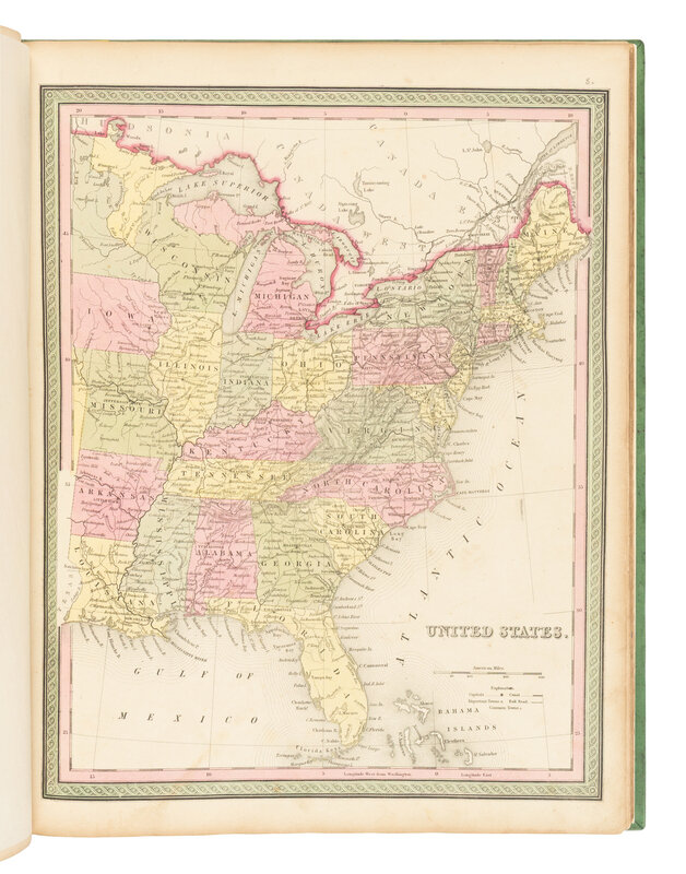
Folio (450 x 356 mm). Lithographic title with large vignette, hand-colored frontispiece, 72 hand-colored lithographed maps. (Map of Palestine dampstained verso, marginal toning or soiling, some spotting.) Modern green calf gilt; slipcase. Provenance: collector's morocco bookplate.
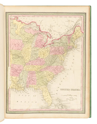
Later edition of Mitchell’s New Universal Atlas, originally published in 1846 after he acquired the rights from Carey & Hart, who had previously published Henry Schenk Tanner’s atlas of the same name. Mitchell updated many of the maps and converted the original copperplate engravings to lithographs. He continued issuing the atlas annually until 1850, when he sold the rights to Thomas, Cowperthwait & Company, later acquired by Charles DeSilver. Though titled as a world atlas, the work is heavily focused on the United States, featuring several important early maps of Texas, the American West (including California), and the Midwest Territories.
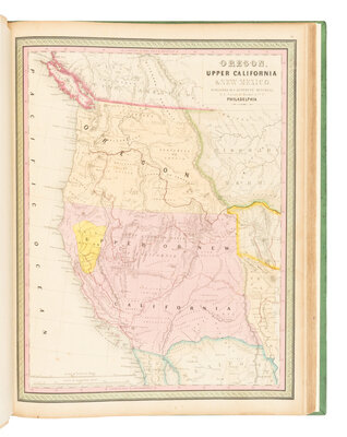
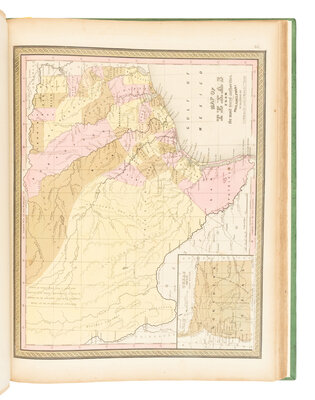
The map of Texas, published by C.S. Williams shortly after the state's annexation to the United States, depicts early major roads, counties, settlements, and battle sites—including the 1836 Battle of San Jacinto. It also features persistent legends such as a “Silver Mine” west of San Antonio and the label “Colorado Hills” still appearing above Austin. West Texas is shown as occupied by Native American tribes. The accompanying map of Oregon and Upper California presents Oregon Territory extending to the Continental Divide, with its northern boundary defined by the Treaty of 1846 with Britain and its southern boundary by the 1819 treaty with Spain. Oregon City is marked as the capital. The routes of Lewis and Clark, John C. Frémont, and the Oregon Trail are charted across wilderness sparsely dotted with missions, forts, and Native American tribes.
The area labeled “Upper or New California” encompasses present-day California, Nevada, Utah, Arizona, and parts of New Mexico, Colorado, and Wyoming. Monterey is identified as the capital, while the gold-rich region is named “Nueva Helvetia.” The unexplored interior is labeled as the “Great Interior Basin of California,” traversed by the Great Spanish Trail from P. Angelos to Santa Fe. Notably, the map places the U.S.–Mexico border significantly farther south than its actual location, resulting in an exaggerated U.S. coastline along the Gulf of California. AN IMPORTANT AND QUINTESSENTIAL ATLAS OF THE 19TH CENTURY. Not in Phillips (only 1848 edition).