
Condition Report
Contact Information
Lot 64
Sale 610 - Fine Cartographic and Printed Americana
Nov 12, 2018
9:59AM
Live
Own a similar item?
Estimate
$800 -
1,200
Price Realized
$2,375
Sold prices are inclusive of Buyer’s Premium
Lot Description
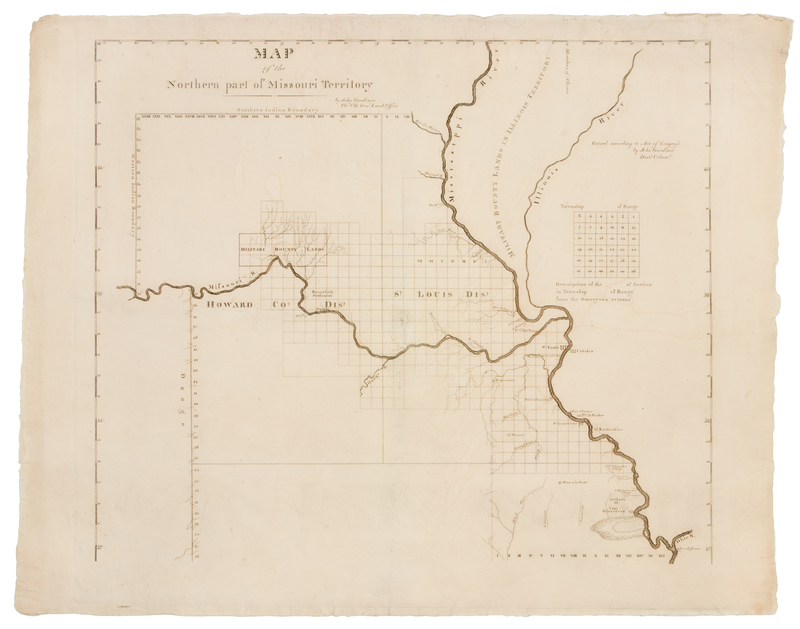
GARDINER, John. Map of the Northern part of Missouri Territory. Washington, D. C.: John Gardiner, [1817?]
Engraved map, image 398 x 468 mm (sheet 463 x 570 mm). FIRST EDITION, "PERHAPS THE FIRST PRINTED MAPS OF MISSOURI TERRITORY" (Streeter). "The surveyed townships at the most northern point are only about 80 miles north of the parallel of St. Louis and the only settlements shown on the Missouri River are St. Charles, near its mouth, Franklin, and Boons Lick Settlement. On the west side of the Mississippi the towns, from north to south, are St. Louis, Carondeleto, Rogers-town, Herculaneum, St. Genevieve, Potosi, Old Shawnee Village, Mine a la Motte, Little Delaware Village, Jackson, and Cape Giradeau." (Streeter III:1841).