Condition Report
Contact Information
Lot 114
Sale 610 - Fine Cartographic and Printed Americana
Nov 12, 2018
9:59AM
Live
Own a similar item?
Estimate
$600 -
800
Price Realized
$1,500
Sold prices are inclusive of Buyer’s Premium
Lot Description
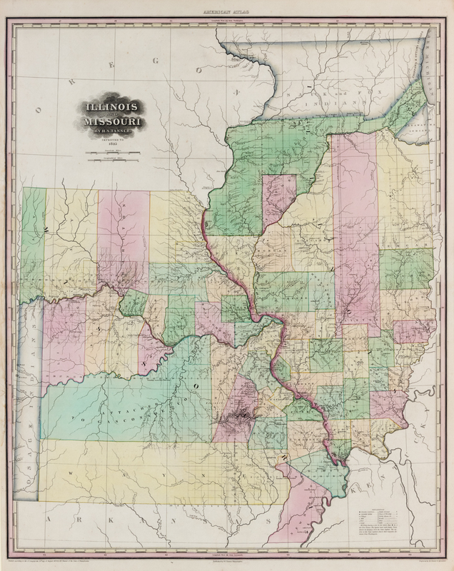
TANNER, Henry Schenck (1786-1858). Illinois and Missouri...Improved to 1825. Philadelphia, 1825.
Engraved map of Illinois and Missouri with hand-coloring, image 706 x 575 mm (sheet 790 x 604 mm), matted and framed. (Some mostly marginal chipping to left margin repaired on verso, short tear in image repaired on verso.) Second edition of one of the first maps to show Illinois and Missouri as states. Tanner's first map of Illinois and Missouri was issued in his 1823 American Atlas. When he published the atlas in 1825, the map was revised to include more detail at the headwaters of the Mississippi. Lexington, Missouri, an important stopping point for travelers on the Santa Fe and Oregon trails, is also added here for the first time. See Phillips 3669 (#12); see Rumsey 2775; see Sabin 94323.