Condition Report
Contact Information
Lot 107
Sale 610 - Fine Cartographic and Printed Americana
Nov 12, 2018
9:59AM
Live
Own a similar item?
Estimate
$2,000 -
3,000
Price Realized
$2,500
Sold prices are inclusive of Buyer’s Premium
Lot Description
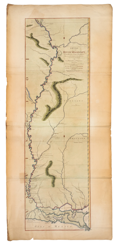
ROSS, John. Course of the River Mississippi from the Balise to Fort Chatres. London: Robert Sayer, 1 June 1772.
Engraved map of the Mississippi River, on two sheets joined, hand-colored in outline and wash, image 1112 x 344 mm (sheet 1228 x 560 mm). (A few short tears, some with repairs, some browning and staining heavier at margins.) FIRST EDITION, FIRST ISSUE, of the first map of the Mississippi based on English sources. Lieutenant John Ross's map shows settlements, forts and villages along the central and lower course of the Mississippi. SCARCE FIRST ISSUE: according to online auction records, no copies have sold at auction in the last 40 years. Stevens & Tree 31a.