Condition Report
Contact Information
Lot 104
Sale 610 - Fine Cartographic and Printed Americana
Nov 12, 2018
9:59AM
Live
Own a similar item?
Estimate
$5,000 -
7,000
Price Realized
$15,000
Sold prices are inclusive of Buyer’s Premium
Lot Description
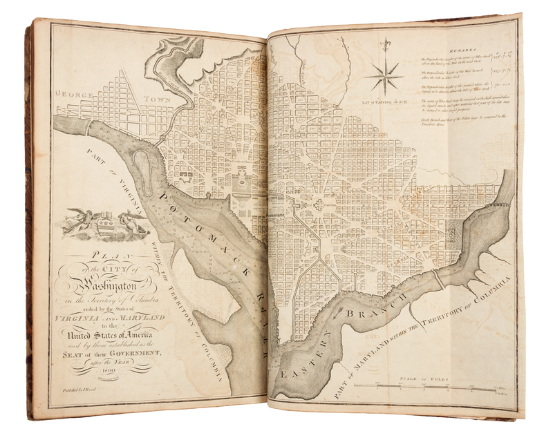
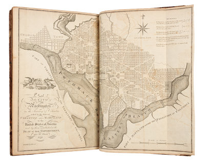
REID, John. The American Atlas. New York: John Reid, 1796.
Small folio (414 x 255 mm). 21 engraved maps, including the added folding plan of Washington D.C. (Some spotting or offsetting, slight chipping or tears to outer margin of map of Maine with a few small losses to blank area reinforced on verso.) Later half brown calf, marbled boards (rebacked preserving original spine, some overall wear).FIRST AMERICAN EDITION, among the first generation of atlases published in the United States, preceded only by Carey's Atlas of 1795 (see lot XXX), at Scott's Gazetteer of 1795 (see lot XXX). The atlas includes the additional detailed plan of Washington (not present in all copies) based on the Ellicott plan of 1792. Reid's is the first atlas to include a map of Washington City. This separate issue of the atlas was originally designed to accompany Winterbotham's History of America of 1796. The continent maps, the general map of the United States and the maps of Kentucky and Washington are from the London edition of Winterbotham's work; the rest are original to this edition. Howes R-170; Phillips 1216; Sabin 69016.