Condition Report
Contact Information
Lot 303
Sale 588 - Fine Books and Manuscripts
Nov 13, 2018
9:59AM
Live
Own a similar item?
Estimate
$4,000 -
6,000
Price Realized
$5,250
Sold prices are inclusive of Buyer’s Premium
Lot Description
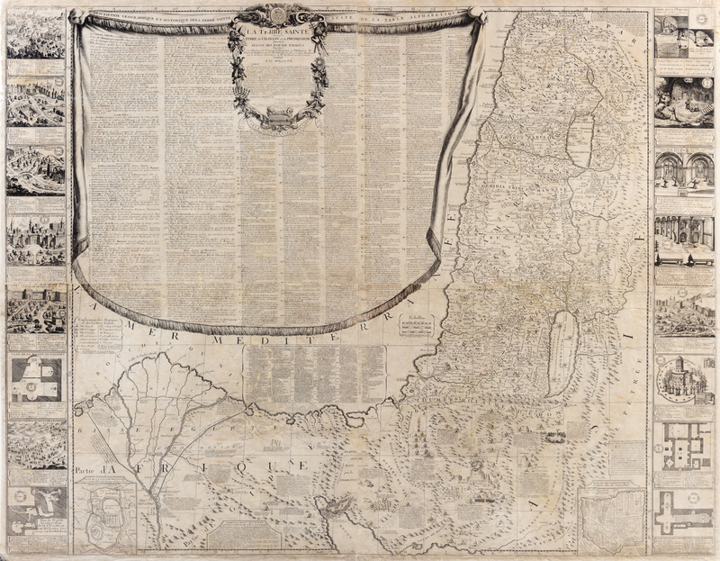
NOLIN, Jean Baptiste (ca 1657-1708). La Terre Sainte Autrefois terre de Canaan et de Promission Divisee Selon Ses Douze Tribus. Paris, 1700.
Engraved map on four sheets of the Holy Land, image 988 x 1237 mm (sheet 1000 x 1258 mm), faint traces of old outline color. (Some light rubbing.) Inset plans of ancient and modern Jerusalem, 8 engraved vignettes and plans, decorative cartouche with liturgical imagery. The map with tiny vignettes such as Moses receiving the tablets on Mount Sinai and the Pyramids, and with historic and topographical captions. A large lettered and numbered draped key includes hundreds of place names. Laor, Maps of the Holy Land 535.