
Condition Report
Contact Information
Lot 63
Sale 568 - Fine Books and Manuscripts
May 1, 2018
9:59AM
Live
Own a similar item?
Estimate
$600 -
800
Price Realized
$594
Sold prices are inclusive of Buyer’s Premium
Lot Description
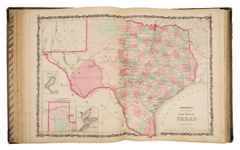
JOHNSON, Alvin J. (1827-1884) and Joseph Hutchins COLTON (1800-1893). Johnson's New Illustrated (Steel Plate) Family Atlas, with descriptions, Geographical, Statistical, and Historical. New York: Johnson and Ward, 1862.
Folio (457 x 372 mm). 97 (of 99) numbered single- and double-page maps, (lacking single leaf numbered 98, 99), numerous wood engravings. (Map numbers 32/33, and 47/48 with damage to left foremargin and centerfolds with tears and repairs affecting image, other leaves with short tears occasionally repaired, some overall browning.) Original half green morocco, covers gilt- and blind-stamped. Nearly complete copy of Johnson's Civil War-era atlas, including maps of Texas and Washington D.C.