Condition Report
Contact Information
Lot 22
Sale 470 - Fine Books and Manuscripts
Nov 2, 2016
9:59AM
Live
Own a similar item?
Estimate
$600 -
800
Lot Description
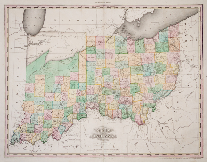
(CARTOGRAPHY) TANNER, HENRY SCHENCK
Ohio and Indiana ... Improved to 1825. Philadelphia: H. S. Tanner, 1825. Second issue.Copper-engraving (60 x 80 cm., sheet). With full period color.An early mapping of Ohio and Indiana, reflecting new boundaries in northern Indiana created by Indian treaties from 1818 and 1819. Other changes include additions of many new roads, including trail extending from Fort Wayne to Fort Dearborn.