Condition Report
Contact Information
Lot 21
Sale 470 - Fine Books and Manuscripts
Nov 2, 2016
9:59AM
Live
Own a similar item?
Estimate
$800 -
1,200
Price Realized
$1,000
Sold prices are inclusive of Buyer’s Premium
Lot Description
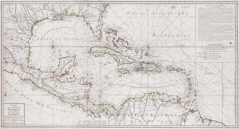
(CARTOGRAPHY) BUACHE, PH. and J.A. DEZAUCHE
Carte du Golphe du Mexique et des Isles Antilles reduite de la grande carte angloise de Popple. Paris: 1780.Hand-colored engraved map (50 x 93 cm., sight); two joined sheets, depicting the Gulf of Mexico, the Caribbean Islands, Central America, and the northern tip of South America. Possessions of the region are shown via a color-coded key at right, beneath a block of explanatory French text.