
Condition Report
Contact Information
Lot 51
Sale 402 - Fine Books and Manuscripts
Nov 11, 2015
3:59AM CT
Live / Chicago
Own a similar item?
Estimate
$15,000 -
20,000
Lot Description
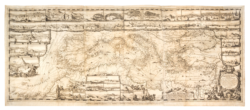
(MAP) (MORTIER, PIERRE) DE HOOGHE, ROMEYN DE
Carte Nouvelle de la Mer Mediterranee ou sont exactement remarques tous les ports, golfes, rochers, banks, de sable &c Amsterdam: Pierre Mortier, c. 1694. Engraved map on three sheets depicting the Mediterranean Sea and surrounding coast line, with 38 insets of major ports and cities of the Mediterranean and large decorative cartouche to lower right corner. One of the most elaborate maps from the Neptune Francois, which "was the most expensive sea-atlas ever published in Amsterdam in the 17th century. Its charts are larger and more lavishly decorated than those of any preceding book of its kind" (Koeman)
25 x 57 inches.