Condition Report
Contact Information
Lot 89
Sale 2600 - Books and Manuscripts
Sep 27, 2023
11:00AM ET
Live / Philadelphia
Own a similar item?
Estimate
$5,000 -
8,000
Price Realized
$6,930
Sold prices are inclusive of Buyer’s Premium
Lot Description
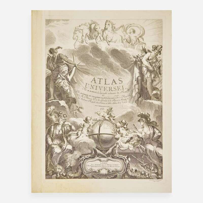
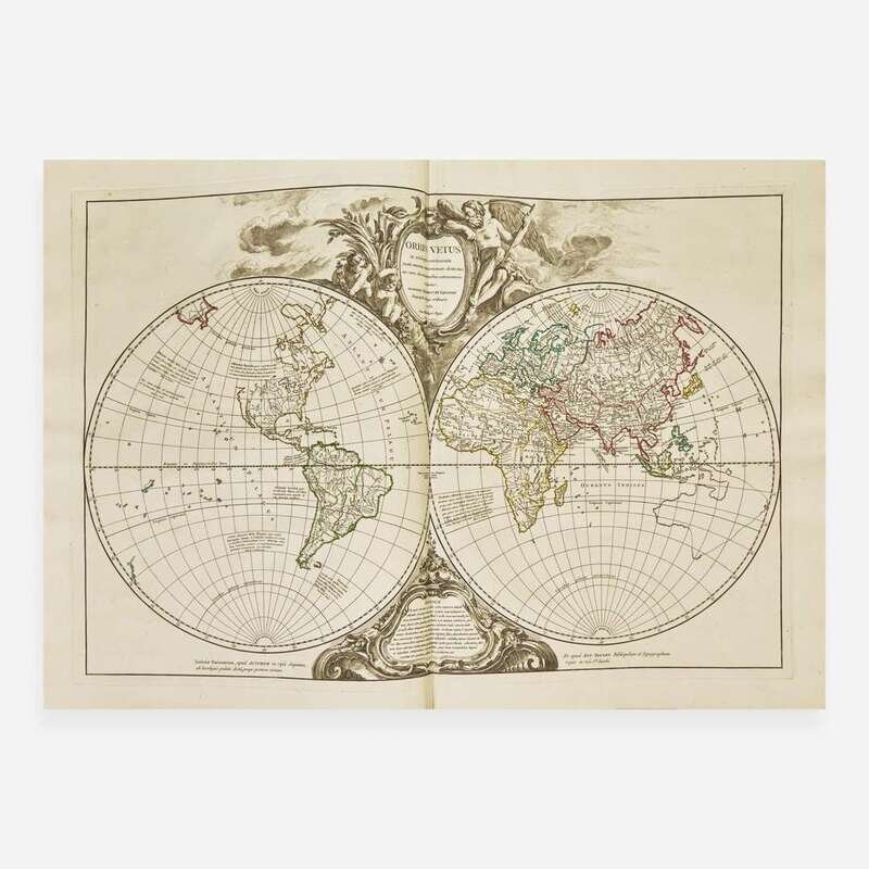
[Maps & Atlases] Vaugondy, (Gilles and Didier) Robert de
Atlas Universel...
Vaugondy, (Gilles and Didier) Robert de
Atlas Universel...
Paris: Chez Les Auteurs, (and) Boudet, 1757-(58). Large folio, 22 x 17 in. (559 x 432 mm). (iv) (engraved title and ad), 40 (preface, table, and list of subscribers) pp. Illustrated with an engraved allegorical title-page by Charles Baquoy after J. Oger and 108 engraved double-page maps with hand-colored outlining (including five additional maps of the post roads supplementing the 103 maps listed in the index). Full contemporary mottled brown calf, red morocco spine label, stamped in blind and in gilt, joints and spine ends expertly restored, scratching and rubbing to boards, chipping along spine, extremities lightly worn; edges stained red; marbled endpapers; printed list of maps mounted to front paste-down, book-plate of Easton Neston Library on same; map names stamped in ink and numbered in contemporary manuscript on verso of each map; light dampstaining in bottom gutter of prelims; scattered spotting in prelims; scattered minor spotting and soiling in margins of some maps; small repair in top corner of map of Savoy; dampstaining in bottom of map of Saint-Domingue, light dampstaining in bottom of preceding four maps; spotting on rear free endpaper and paste-down; in brown cloth fall-down-back box. Sabin 71864; Shirley T.ROBV-1b-1d A handsome large-paper copy of this important 18th-century French atlas by leading French mapmakers, the father and son team of Gilles and Didier Robert de Vaugondy. Featuring 108 impressive hand-colored engraved maps, including 12 maps of the ancient world and 96 maps of the modern world, and with the final seven maps relating to the Americas. Considered one of the most important atlases of the 18th-century, it was issued by subscription beginning in 1752 shortly following the establishment of Gilles's shop in Paris, and reached over 1,118 copies. This copy includes five additional maps of post roads in the British Isles, France, Germany, Spain, Portugal, and Italy, that were made available to subscribers for the additional cost of 6 livres. The map of Virginia and Maryland is based on Fry and Jefferson's map, while the maps of Canada and South America are based on material held by the Depot de la Marine.