
Condition Report
Contact Information
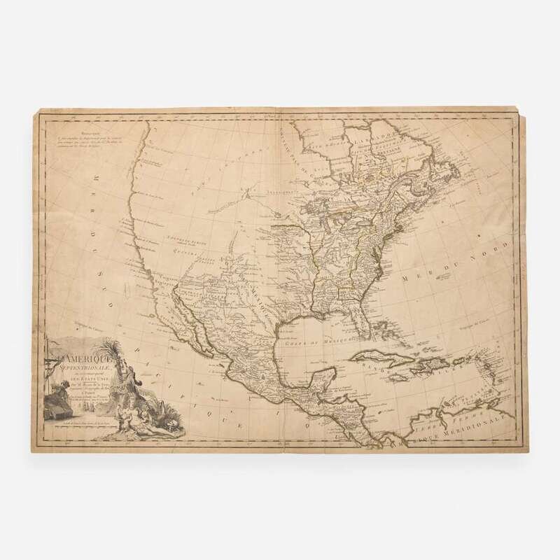
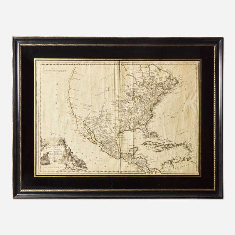
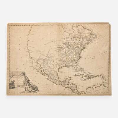
Lot 147
Lot Description
One of the Earliest Maps to Name the United States
Paris: Esnauts et Rapilly, 1779. First state. Engraved map with hand-colored outlining, 20 3/4 x 29 1/2 in. (527 x 749 mm). Repaired short closed tear in upper right edge; repaired tear in left edge; small loss in top corners; scattered light soiling along recto edges; ink smudge bottom left; faint dampstaining in top right; wear along verso edges. Mounted in mat, and in frame, 28 5/8 x 37 3/8 in. (651 x 949 mm). Sellers & Van Ee 166
A well preserved and rare example of Louis Brion de la Tour's 1779 map of North America during the American Revolution, considered one of the first maps to name the United States, and published a year following France and the United States's Treaty of Alliance. This map was preceded by J.B. Eliot's 1778 map of the United States (often considered the first map to name the United States), the 1778 reissue of Robert de Vaugondy’s map of Canada, and presumably others. De la Tour printed two other states of this map, in 1783 and in 1788, which are scarce but more common, and this first state is much rarer. We can locate only two other examples at auction, in 2001, and in 2020.