Condition Report
Contact Information
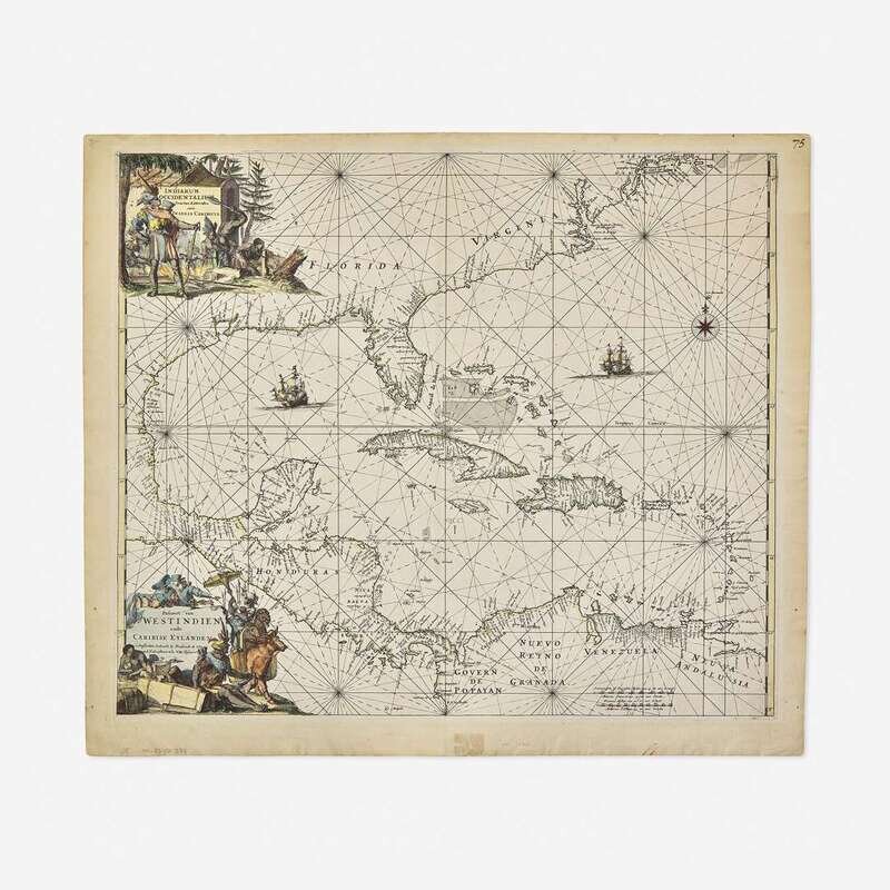
Lot 106
Lot Description
(Amsterdam, ca. 1675-80). Engraved map of Central America and the Caribbean, with vibrant hand-coloring. Unrecorded early variant between first and second state, with "23" printed top right corner, no sea names printed, but printed with the south coast of New England, New Netherlands, and the west coast of Central America. Corners mounted to mat; a few small worm holes, bottom left and right edges; short repaired closed tear, bottom center edge; pagination in MS., top right corner; margins lightly soiled. 21 1/8 x 24 3/8 in. (536 x 619 mm). In mat, 27 1/8 x 29 1/2 in. (689 x 749 mm). Burden 468
A rare and unrecorded early variant of Frederick de Wit's famed map of Central America, the West Indies, and the East Coast of America up to New England and New Netherlands, from his Orbis Maritimus ofte Zee Atlas.