
Condition Report
Contact Information
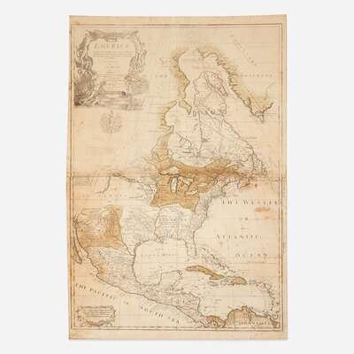
Lot 105
Lot Description
London: John Senex, 1710. Engraved map, with contemporary hand-coloring (darkened). 40 x 26 3/4 in. (102 x 68 cm). Laid down on linen; toned; scattered spotting; scattered short closed tears along edges. In frame, 42 3/4 x 29 1/2 in. (108 x 75 cm). Tooley/Stevens & Tree 61 (variant, with Price and Maxwell's names deleted from title, and without imprint below scales, bottom left).
An early large-scale and influential English map of North America, featuring some of the-then most up-to-date cartographic information regarding the region. Senex drew heavily on French cartographer Guillaume de l'Isle (1675-1726), consolidating several of his influential maps to depict the region from the north in Canada from Baffin Bay and terra incognito above it, down south to Mexico and Central America, and out west to California.