Condition Report
Contact Information
Lot 91
Sale 5657 - Books and Manuscripts
Sep 23, 2021
6:00AM ET
Live / Philadelphia
Own a similar item?
Estimate
$1,200 -
1,800
Price Realized
$4,410
Sold prices are inclusive of Buyer’s Premium
Lot Description
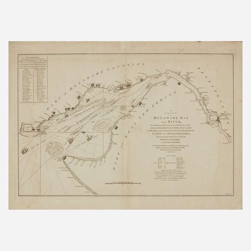
[Philadelphia] Fisher, Joshua A Chart of Delaware Bay and River…
London: Andrew Dury, 1776. 21 3/4 x 30 in. (552 x 762 mm). Engraved map, by W. Haydon. Creased along center from original fold; two tape repairs verso; slightly darkened; faint dampstaining along edges. In frame, 23 1/8 x 31 1/2 in. (587 x 800 mm).
An early London derivative of Joshua Fisher's important chart of the Delaware Bay and river, first produced in 1756, then expanded in 1775, to aid navigation for ships sailing toward Philadelphia. The map is oriented to the west, with Philadelphia depicted at the far right, and extends to Cape Hinlopen at the far left, with Cape May at bottom. A handsome example.