Condition Report
Contact Information
Auction Specialist
Lot 284
Sale 1095 - American Historical Ephemera & Photography, Featuring Property from the James Milgram, M.D., Collection of Broadsides, Ephemeral Americana & Historical Documents
Day 1 Lots 1-403
Nov 3, 2022
10:00AM ET
Day 2 Lots 404-634
Nov 4, 2022
10:00AM ET
Live / Cincinnati
Own a similar item?
Estimate
$600 -
800
Price Realized
$2,250
Sold prices are inclusive of Buyer’s Premium
Lot Description
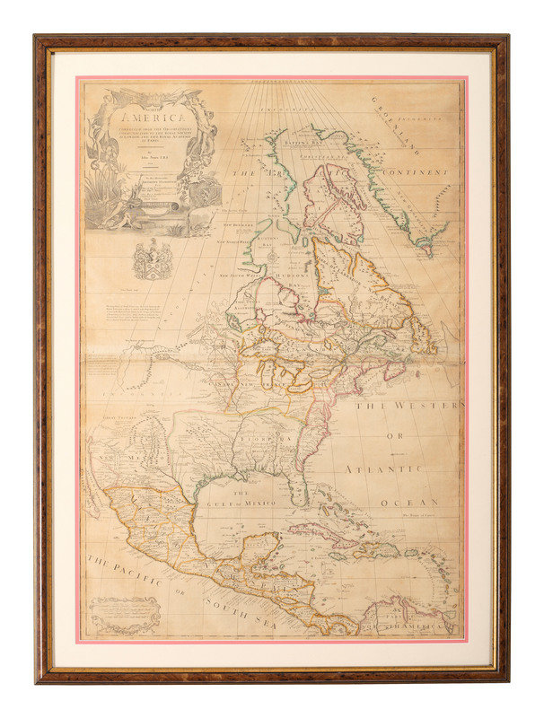
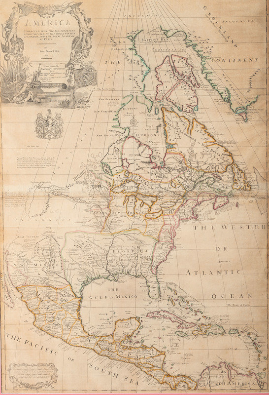
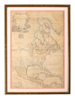
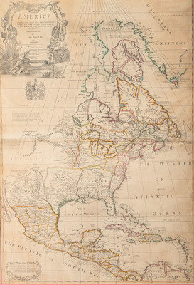
[MAPS & ATLASES]. SENEX, John (1678-1740). North America Corrected from the Observations Communicated to the Royal Society at London and the Royal Academy at Paris. London: N.p., 1710.
Copper engraved map on two sheets joined, hand-colored in outline, visible 25 1/2 x 37 1/4 in. (Some toning, short tear near Baffin Bay, old creases.) Matted and framed. Third state as identified by Barry Lawrence Ruderman (second state listed in Stevens & Tree) with "By John Senex F. R. S. 1710". With Price & Maxwell's name deleted from the title, as seen in the first state. No imprint beneath the scales in the lower left, as seen in later states.
Considered one of the earliest and most accurate large-scale maps of North America produced in England. Senex incorporated information from recently published works including Delisle's Carte du Mexique et de la Floride and Carte de la Canada, himself improving upon this foundation with excellent depictions of the Great Lakes region and the lower Mississippi River and delta. Also includes Lahontan's mythical Long River, Terra Incognita beyond Baffin Bay, and some strange locations and rivers in west Texas. Stephens & Tree 61a*.
Estate of Carroll J. Delery III, Formerly the “Historical Shop”
This lot is located in Cincinnati.