Condition Report
Contact Information
Auction Specialist
Lot 870
Sale 1047 - American Historical Ephemera & Photography
Lots Open
Jun 17, 2022
Lots Close
Jun 28, 2022
Timed Online / Cincinnati
Own a similar item?
Estimate
$200 -
300
Price Realized
$125
Sold prices are inclusive of Buyer’s Premium
Lot Description
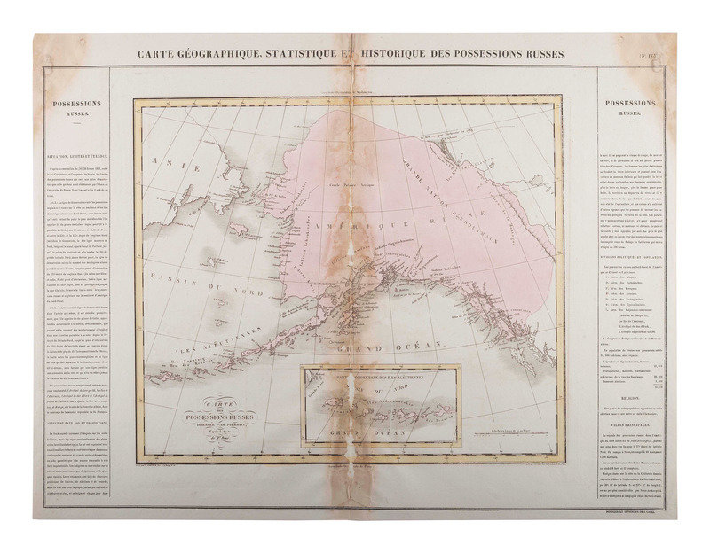
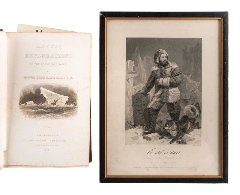
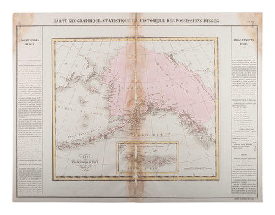
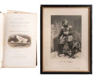
[ALASKA]. One of the earliest maps of Alaska as Russian possession [With:] books and engraving of Elisha Kent Kane.
BUCHON, Jean Alexandre (1791-1849). Carte Géographique, Statique et Historique des Possessions Russes. Paris: J. Carez, 1825. Engraved map of Russian America, hand-colored, image 340 x 376 mm (660 x 497 mm sheet). Inset of the Western Aleutian islands. (Dampstains to upper corners and along center crease with separations.) A scarace map of Russian Alaska, possibly the first separate map of the region, 42 years before it's acquisition by the United States.
[With:] KANE, Elisha Kent (1820-1857). Arctic Explorations in the Years 1853,
'54, '55. Philadelphia: Childs and Peterson, 1856. 2 volumes, 8vo. Plates and in-text engravings. (Toning, occasional spotting.) Original pictorial cloth, spines gilt lettered (partial hinge separtion in vol. I, wear to extremities.)
[Also with:] JOHNSON, FRY & Co., publishers. after Alonso CHAPPEL, artist. E.K. Kane. Engraving, 1862, image 133 x 186 mm (197 x 270 mm visible), framed, minor spotting.