
Condition Report
Contact Information
Lot 234
Sale 800 - Fine Books and Manuscripts
Lots 1-273
Nov 12, 2020
4:00AM CT
Lots 274-476
Nov 13, 2020
4:00AM CT
Live / Chicago
Own a similar item?
Estimate
$800 -
1,200
Price Realized
$1,063
Sold prices are inclusive of Buyer’s Premium
Lot Description
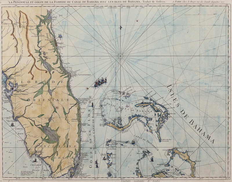
[JEFFERYS, Thomas]. La Peninsule et Golfe de la Floride ou Canale de Bahama avec les Isles de Bahama. Paris: Le Rouge, 1777.
Engraved map of Florida with hand coloring, visible area 482 x 705 mm, matted and framed, unexamined out of frame. (A few tiny holes, some light dampstaining.) French edition of Jefferys' map of Florida, comprising one sheet of a larger two-sheet map depicting Florida and the Gulf region (without Carte De La Floride Occidentale et Louisiane, which details the Gulf region and the Florida Panhandle). The map was produced to be included in Le Rouge's Pilote Americain Septentrionale, printed for the use of the French Navy during the American Revolution, which drew on the North American Pilot (1775).