
Condition Report
Contact Information
Lot 238
Sale 654 - Fine Books and Manuscripts
May 1, 2019
9:59AM CT
Live / Chicago
Own a similar item?
Estimate
$1,500 -
2,500
Price Realized
$1,375
Sold prices are inclusive of Buyer’s Premium
Lot Description
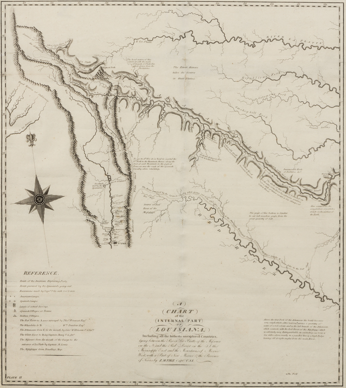
PIKE, Zebulon Montgomery, Major (1779-1813). A Chart of the Internal Part of Louisiana, Including All the Hitherto Unexplored Countries... [Philadelphia, 1810].
Engraved map of Louisiana, visible area 17 1/2 x 15 1/2 in. (443 x 393 mm). Matted and framed (not examined out of frame).
Printed for inclusion in Pike's landmark report of the Southwest, An Account of Expeditions to the Sources of the Mississippi, and Through the Western Parts of Louisiana, to the Sources of the Arkansaw, Kans, La Platte, and Pierre Jaun, Rivers... According to Wheat, this was one of "the first maps of this entire region to display knowledge derived from actual explorations....[a] milestone...in the mapping of the American West." Wheat Transmississippi West 298.