
Condition Report
Contact Information
Lot 233
Sale 654 - Fine Books and Manuscripts
May 1, 2019
9:59AM CT
Live / Chicago
Own a similar item?
Estimate
$500 -
700
Price Realized
$500
Sold prices are inclusive of Buyer’s Premium
Lot Description
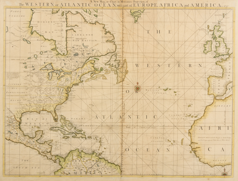
HERBERT, William (1718-1795) and John SENEX (1678-1740). A New Map, or Chart in Mercator's Projection, of The Western or Atlantic Ocean, with part of Europe, Africa and America. London, 1757.
Engraved map, with contemporary hand-coloring in outline, sheet 25 1/8 x 33 5/8 in. (638 x 856 mm). (Short tear to upper margin touching letters, a few separations repaired verso, crease lower right corner with short tear.)
RARE printing of Herbert's edition of Senex's sea chart. After Senex's death in 1740, his wife took over his stock and trade; she sold the business in about 1755 to Herbert.