
Condition Report
Contact Information
Auction Specialist
Lot 313
Sale 6431 - American Historical Ephemera & Early Photography Online
Lots Open
Nov 11, 2025
Lots Close
Nov 24, 2025
Timed Online / Cincinnati
Own a similar item?
Estimate
$500 -
700
Price Realized
$0
Sold prices are inclusive of Buyer’s Premium
Lot Description
[MAPS & ATLASES]. "Maps. Andrews Report." [With:] "Maps. Gibbon's Report."
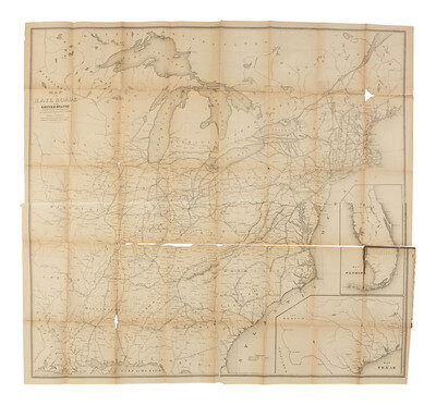
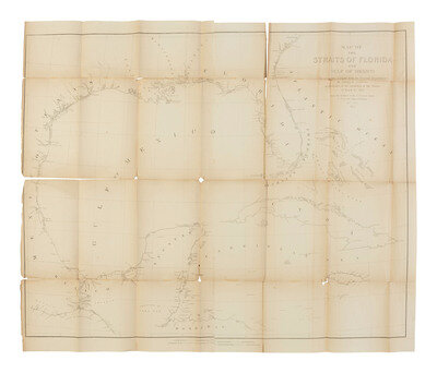
ANDREWS, Israel De Wolfe (1813-1871). "Maps. Andrews Report." [Treasury Department]: [Washington, D.C.], 1853. Four maps bound into a single volume. Brown cloth boards with gilt title, approx. 6 x 9 1/4 in. (heavy wear to boards, completely separated at spine, maps with chipping, losses, creasing, and toning).
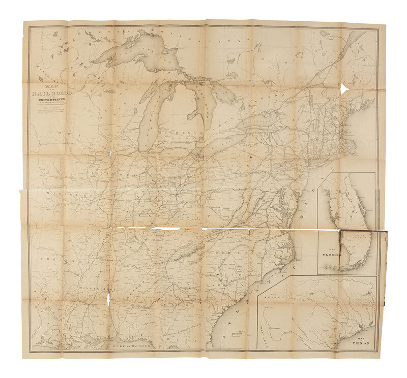
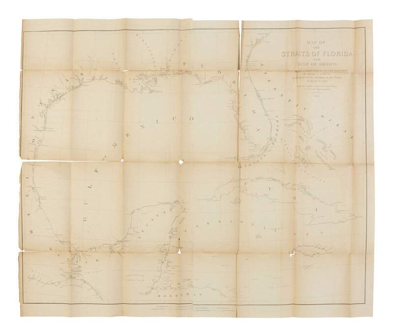
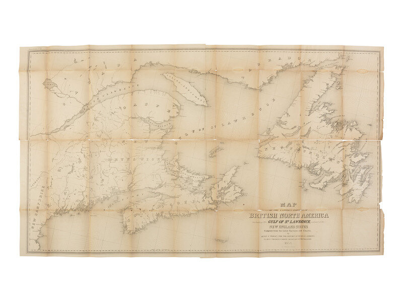
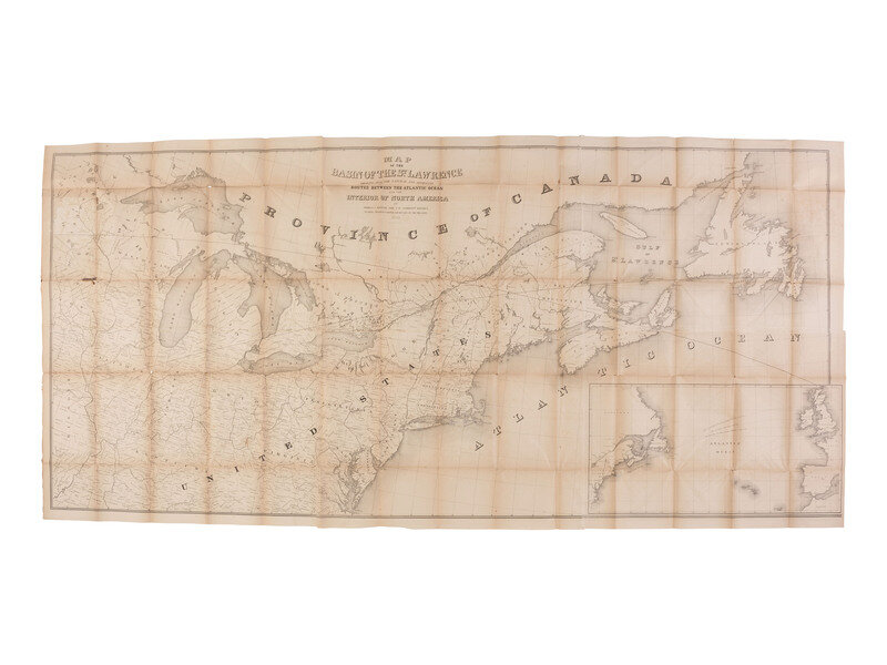
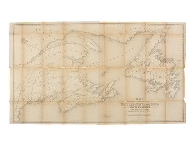
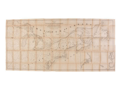
Maps include: "Map of the Railroads in the United States in operation and progress to accompany a report from the Treasury Department by Israel D. Andrews drawn and engraved under the direction of the editor of the American Rail Road Journal." A.M. Modelski (US) 25. (32nd Cong, 1st sess. Senate. Ex.Doc. No. 112). Large detailed early railroad map with two insets, Texas and Florida. Approx. 100 x 108 cm. -- "Map of the eastern portion of British North America including the Gulf of St. Lawrence, and part of the New England States...." Approx. 65 x 115 cm. -- Map of the Straits of Florida and Gulf of Mexico...." Approx. 67 x 88 cm. -- "Map of the Basin of the St. Lawrence showing also the natural and artificial routes between the Atlantic Ocean and the interior of North America...." Approx. 88 x 192 cm.
Maps issued with the Andrews "Report on the Trade and Commerce of the British North American Colonies...." The "Andrews Report" was a comprehensive 1853 report commissioned by the U.S. Treasury Department that analyzed trade and commerce between the United States and British North American colonies. Israel Andrews served as a United States consul, special agent, and lobbyist who was instrumental in shaping the Canadian-America Reciprocity Treaty of 1854.
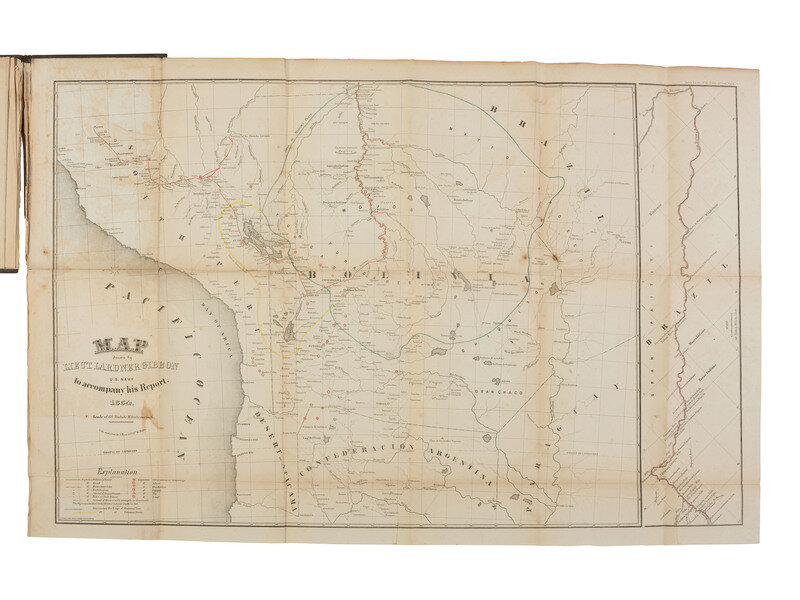
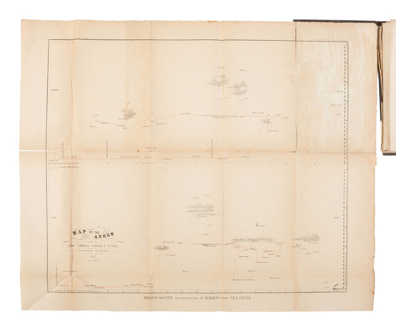
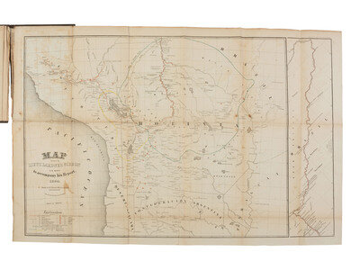
[With:] GIBBON, Lt. Lardner (1820-1910). "Maps. Gibbon's Report." [Washington, D.C.], Lithographed & printed by A. Hoen & Company, 1854. Two maps bound into a single volume. Brown cloth boards with gilt title, approx. 6 x 9 1/4 in. (heavy wear to boards, near complete separation at spine, maps with chipping, losses, creasing, and toning). Includes "Map of the Andes Drawn by Lieut. Lardner Gibbon, to Accompany his Report," approx. 60 x 48 cm, and "Map Drawn by Lieut. Lardner Gibbon, U.S. Navy, to Accompany his Report," approx. 50 x 78 cm.
Maps issued with a report to the Congress of the United States regarding an exploration of the Valley of the Amazon carried out by the U.S. Navy in the 1850's. Under the leadership of U.S. Navy Lieutenants William Lewis Herndon and Lardner Gibbon, the expedition left Lima Peru on 21 May 1852 and reached Para, Brazil on 11 April 1852, a distance of 4,366 miles. The Report was published by the Navy in 1854 in two volumes as "Exploration of the Valley of the Amazon", the second authored by Lieut. Gibbon with these maps an addition.
This lot is located in Cincinnati.