

Condition Report
Contact Information
Auction Specialist
Lot 225
Sale 6417 - Fine Printed Books & Manuscripts, Including Americana
Sep 10, 2025
10:00AM ET
Live / Philadelphia
Own a similar item?
Estimate
$1,500 -
2,500
Price Realized
$1,664
Sold prices are inclusive of Buyer’s Premium
Lot Description
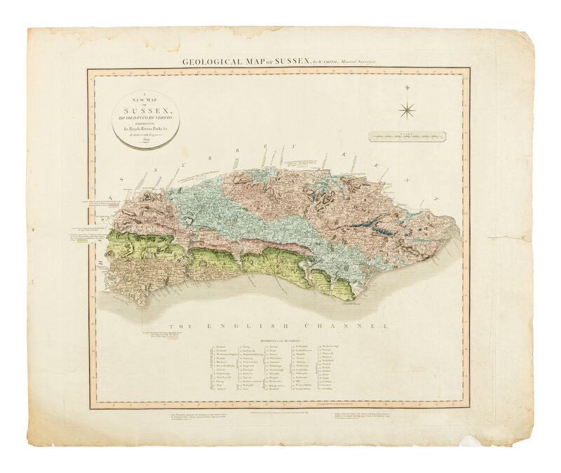
[Maps & Atlases]. Smith William. A New Map of Sussex, Divided into Hundreds, Exhibiting Its Roads, Rivers, Parks, &c.
London: John Cary Engraver & Map-seller, Jan. 1819. Engraved map with hand-coloring. Soiling and toning to margins; dampstaining in upper margin, a few tears near edges, including a three-inch closed tear slightly touching platemark; repaired on verso. 23 x 28 in. (584 x 705 mm).
William Smith's rare geological survey of Sussex.
Smith produced the first geological map of England and Wales in 1815, titled A Delineation of the Strata of England and Wales, with Part of Scotland. This was the first geological map of an entire country, systematically created using Smith's principle of faunal succession, which correlated rock layers based on their fossil content, which contained “an amazing amount of correct detail” (DSB) and was the basis for all the geological maps that followed. In 1819, he began the publication of a geological atlas of England and Wales. Containing twenty-one maps of various English counties, it was published in parts over five years, but remained unfinished. The map is a reissue of Cary’s map of 1801, with the addition of the geological information.
This lot is located in Philadelphia.