


Condition Report
Contact Information
Auction Specialist
Lot 247
Sale 6356 - American Historical Ephemera and Photography
Lots Open
Jun 18, 2025
Lots Close
Jul 2, 2025
Timed Online / Cincinnati
Own a similar item?
Estimate
$100 -
150
Price Realized
$61
Sold prices are inclusive of Buyer’s Premium
Lot Description
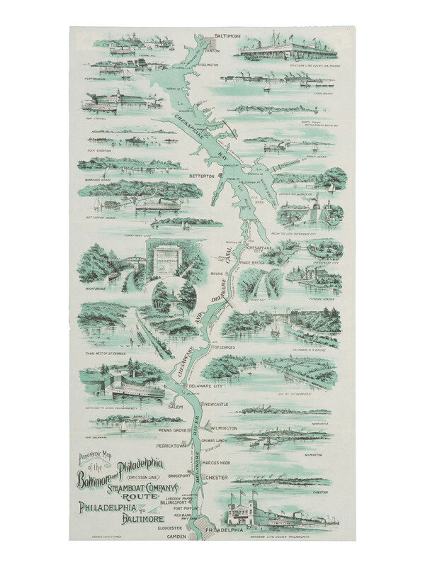
[TRANSPORTATION] Panoramic Map of the Baltimore and Philadelphia Steamboat Company's Route. Ca 1897.
Philadelphia: Webster & Hunter, ca 1897. 21 5/8 x 11 7/8 in. lithographed map, framed to 23 3/4 x 14 1/4 in.
An illustrated map showing the Steamboat route between Baltimore and Philadelphia along the Chesapeake Bay, the Chesapeake and Delaware Canal, and the Delaware River. Enhanced with vignettes of the towns and sites along the route. The Canal was opened in 1829, though a waterway was conceived as early as the 17th century to connect the nearby bodies of water. The Baltimore and Philadelphia Steamboat Company, also known as the Ericsson Line named after its first ship, opened shortly thereafter in 1844 and operated until 1934. RARE: only one other copy located, with imprint of the Anvil Print Company in the lower right.
Property from the James Milgram, M.D., Collection of Ephemeral Americana and Historical Documents
This lot is located in Cincinnati.