Condition Report
Contact Information
Lot 99
Sale 610 - Fine Cartographic and Printed Americana
Nov 12, 2018
9:59AM
Live
Own a similar item?
Estimate
$5,000 -
7,000
Price Realized
$20,000
Sold prices are inclusive of Buyer’s Premium
Lot Description
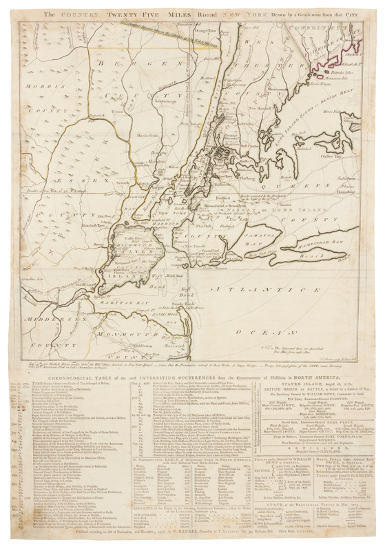
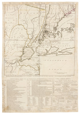
[NEW YORK]. The Country Twenty Five Miles Round New York, Drawn by a Gentleman from that City. London: W. Hawkes (Successor to T. Kitchin), 21st November 1776.
Broadside, sheet 588 x c.410 mm (23 1/8 x ca 16 in.), plate 395 x 405 mm (15 7/8 x 15 1/2 in.). Engraved map by J. Barber ("J. Barber sculp Holborn Hill"), lightly hand-colored in outline in yellow and green, signed in the plate With letterpress text printed on same sheet below in three columns headed: "Chronological Table of Most Interesting Occurrences since the Commencement of Hostilities in North America." (Left margin unevenly trimmed, some minor soiling, several paper repairs and mounting remnants on verso with minor discoloration, a few very pale dampstains.) The Chronological Table begins with the mention of what would later be known as the Boston Tea party on December 16th, 1773 ("Three Hundred Forty-two Chests of Tea destroyed at Boston"). And proceeds to recount the events of the war itself, most notably the Battle of Bunker Hill outside Boston ("Action on Bunker's Hill"), and the British evacuation of Boston on March 7th, 1776. The text beside the date July 4th, 1776 reads: "General Congress declare the United States of America Independent." The events over the summer include Howe's landing on Long Island on August 22nd, Sullivan's defeat on August 27th ("Provincials under Major General Sullivan, defeated near Brookland, on ditto"), and end on August 29th "Provincials, under General Putnam, abandon their Lines on Long Island." The text section also provides a great deal of important information including an "Alphabetical Table of the Principal Towns in North America and their Distance from New York," a table listing the population statistics of the various American colonies, and information regarding the command structure, troop strength, and the general disbursement of both the British and American forces. AN EXCEEDINGLY RARE BROADSIDE MAP DOCUMENTING THE DRAMATIC EVENTS UNFOLDING DURING BRITAIN'S NEW YORK CAMPAIGN AT THE OUTSET OF THE REVOLUTIONARY WARThis early state is dated 21 November 1776 in the imprint and contains an extra engraved line beneath border of the map bringing the information down to Oct. 13th. It is unrecorded among the four listed in Stevens & Tree, which describes the first state dated 1 November 1776 and bearing a single engraved line beneath the border of map which begins "Sept. 15. 1776 British Forces", the second issue he lists is dated 21 November 1776 and contains an extra engraved line beneath border of map bringing the information down to November 1, 1776; the third state has imprint dated 1 January 1777; and the fourth state was published by R. Sayer & J. Bennett 2 June 1777 and with the two engraved lines bringing information down to 16 November. Reese offered the third state in Catalogue 273, item 86. Nebenzahl mentions the present state as being between Stevens & Tree 43a & 43b. Nebenzahl 110; see Stevens & Tree 43; see Streeter II:786 (43d later issue).