Condition Report
Contact Information
Lot 83
Sale 610 - Fine Cartographic and Printed Americana
Nov 12, 2018
9:59AM
Live
Own a similar item?
Estimate
$200 -
300
Price Realized
$469
Sold prices are inclusive of Buyer’s Premium
Lot Description
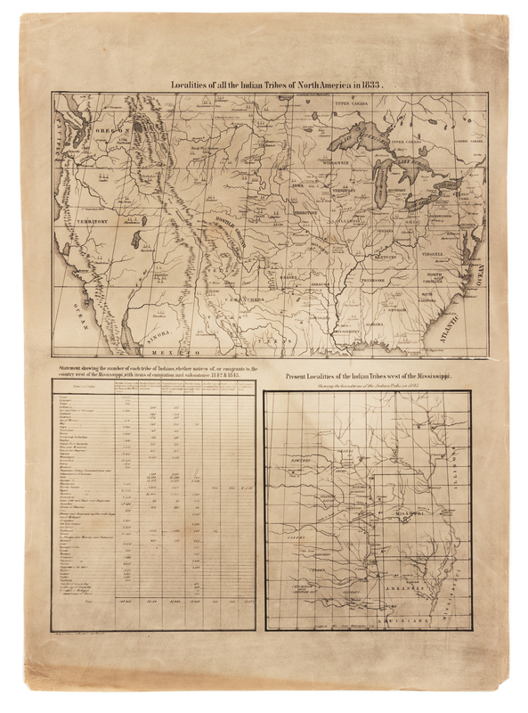
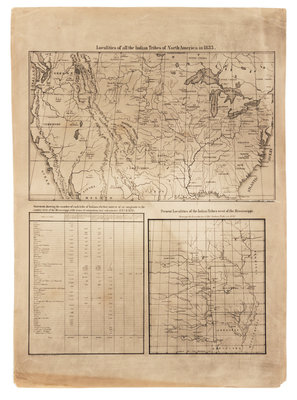
[McKENNEY, Thomas L. (1785-1859) and James HALL (1793-1868)]. Localities of All the Indian Tribes of North America in 1833 & Present Localities of the Indian Tribes West of the Mississipi. [Philadelphia]: J. T. Bowen & Co., [1837-42].
2 lithographic maps printed on a single sheet, (sheet 532 x 385 mm). Overall view of the United States and a detail of Missouri, Arkansas, and parts of Illinois and Louisiana. (2 -in. tear crossing image, a few short marginal tears or creases, some spotting and browning.) The only maps to appear in History of the Indian Tribes of North America, the top map marks the locations of all of the Native American tribes with a tepee symbol, and the lower chart and map describe the forced migration of tribes after the 1830 signing of the Indian Removal Act.