
Condition Report
Contact Information
Lot 67
Sale 610 - Fine Cartographic and Printed Americana
Nov 12, 2018
9:59AM
Live
Own a similar item?
Estimate
$600 -
800
Price Realized
$406
Sold prices are inclusive of Buyer’s Premium
Lot Description
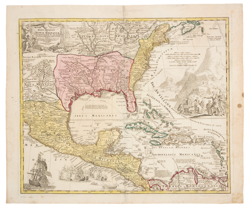
HOMANN, Johann Baptist (1663-1724). Regni Mexicani seu Novae Hispaniae, Ludovicianae, N. Angliae, Carolinae, Virginiae et Pensylvaniae. Nuremberg: Homann, [ca 1730].
Engraved map of the East Coast, Mexico and the Caribbean, with hand-coloring in outline and wash, image 475 x 568 mm (sheet 539 x 643 mm). Decorative cartouche, gold mining scene in the Atlantic Ocean, naval battle scene in the Pacific Ocean. (Slight mostly marginal soiling, remnants of binding stub along crease on verso.) Homann's map, based on Delisle's Carte du Mexique et de la Floride of 1703, shows the Great Lakes and Nova Scotia through Central America, New Mexico through the East Coast, the Caribbean and Venezuela, and depicts the results of Queen Anne's War. Phillips 622 (#147).