Condition Report
Contact Information
Lot 310
Sale 588 - Fine Books and Manuscripts
Nov 13, 2018
9:59AM
Live
Own a similar item?
Estimate
$500 -
700
Price Realized
$531
Sold prices are inclusive of Buyer’s Premium
Lot Description
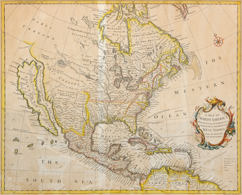
SEALE, Richard William. A Map of North America With the European Settlements & whatever else is remarkable in ye West Indies from the latest and best Observations. [London, 1745].
Engraved map, image 373 x 464 mm (visible area 380 x 475 mm) hand-colored in outline, matted and framed. (Not examined out of frame, some browning or spotting, laid down.) North American map showing a very late example of California as an island, depiction the Mississippi Valley, the Great Lakes and Transmississippi West in great detail. McLaughin 228.