
Condition Report
Contact Information
Lot 57
Sale 568 - Fine Books and Manuscripts
May 1, 2018
9:59AM
Live
Own a similar item?
Estimate
$3,000 -
5,000
Price Realized
$3,000
Sold prices are inclusive of Buyer’s Premium
Lot Description
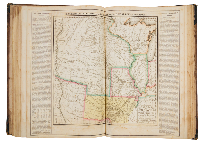
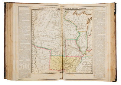
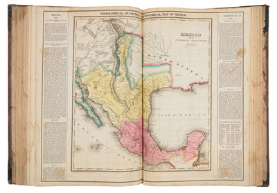
CAREY, Henry Charles (1793-1879) and Isaac LEA (1792-1886) A Complete Historical, Chronological, and Geographical American Atlas. Philadelphia: Carey & Lea, 1822.
Folio (445 x 305). 47 hand-colored engraved maps printed within wide text borders, 3 hand-colored double-page charts, uncolored double-page engraved chart depicting comparative heights of mountains and lengths of rivers, mounted on guards. (Some spotting and browning.) Contemporary half roan, boards (worn, upper cover detached, endpapers torn, lower hinge starting, some staining). FIRST EDITION of one of the most important early American atlases, with the state maps mostly after F. Lucas, Jr. Wheat calls Stephen H. Long's map of the Arkansas Territory "the most interesting in the atlas." This edition is the first atlas to show Mexico as a country. Phillips 1373a; Wheat Mapping of the Transmississippi West 2:81.