Condition Report
Contact Information
Lot 53
Sale 503 - Fine Books and Manuscripts
Sep 13, 2017
9:59AM
Live
Own a similar item?
Estimate
$800 -
1,200
Price Realized
$750
Sold prices are inclusive of Buyer’s Premium
Lot Description
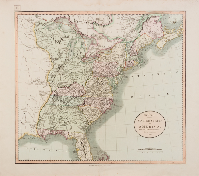
CARY, John (ca.1754-1835)
A New Map of the United States of America, from the latest authorities. London, 1806. Hand-colored engraved map of the United States, image 454 x 508 mm (541 x 650 mm). (A few short marginal tears, vertical crease at center, small marginal hole.) The Georgia Territory stretches to the Mississippi River, encompassing present-day Alabama and Mississippi, and the map includes tips for navigating some of the rivers, including the Mississippi, the Ohio, and the Wabash.