Condition Report
Contact Information
Lot 40
Sale 503 - Fine Books and Manuscripts
Sep 13, 2017
9:59AM
Live
Own a similar item?
Estimate
$1,000 -
1,500
Price Realized
$813
Sold prices are inclusive of Buyer’s Premium
Lot Description
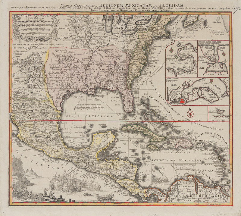
LOTTER, Tobias Conrad (1717-1777)
Mappa geographica regionem Mexicanam et Floridam. [Augsburg, after 1740].Hand-colored engraved map of Mexico and Florida, image 473 x 577 mm (538 x 625 mm sheet). Inset plans of Panama, Havana, Cartagena, and Vera Cruz, decorative cartouche, sea battle scene lower left. (A few tiny marginal holes). This issue by Lotter, with his name replacing Seutter's in the title. The inset plans represent important trade sites in the Atlantic, and the map depicts Spanish trade routes.