

Condition Report
Contact Information
Lot 25
Sale 470 - Fine Books and Manuscripts
Nov 2, 2016
9:59AM
Live
Own a similar item?
Estimate
$1,000 -
1,500
Price Realized
$1,125
Sold prices are inclusive of Buyer’s Premium
Lot Description
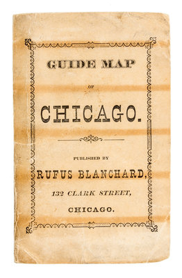
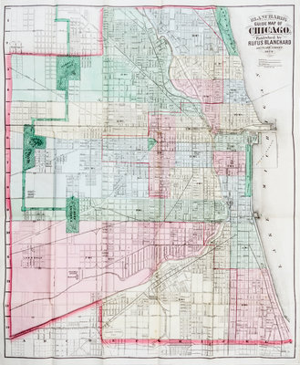
(CARTOGRAPHY) (POST-FIRE CHICAGO)
Blanchard's guide map of Chicago. Rufus Blanchard, 1872.Engraved folding pocket-map (56 x 43 cm.), which folds into publisher's lettered paper covers; street guide tipped to inside wrapper (14 pages). With full contemporary hand-coloring.A street map of Chicago, showing the city just one year after the Fire. The limits of the burnt region are outlined by a thin dotted line. The accompanying pamphlet provides index to city's streets via letter-number grid. With city's parks, public buildings, and railroads also identified.