Condition Report
Contact Information
Lot 39
Sale 402 - Fine Books and Manuscripts
Nov 11, 2015
3:59AM CT
Live / Chicago
Own a similar item?
Estimate
$400 -
600
Price Realized
$500
Sold prices are inclusive of Buyer’s Premium
Lot Description
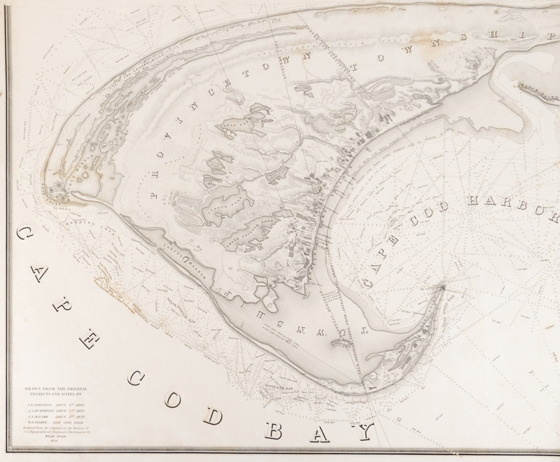
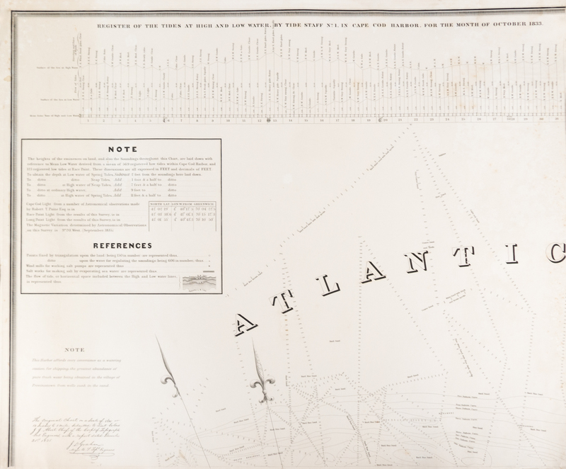
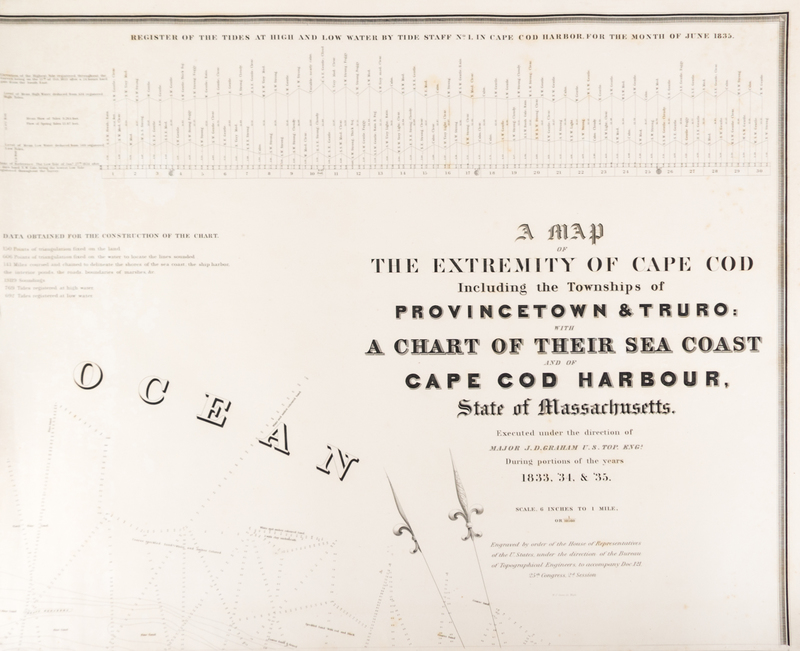
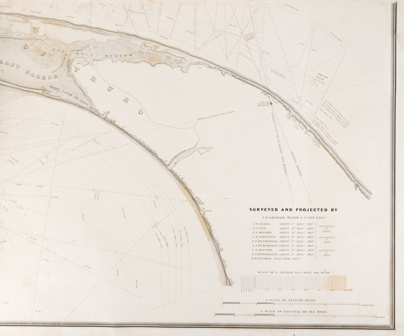
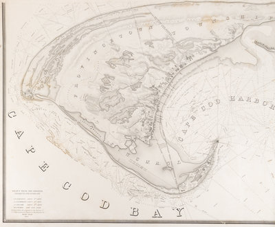
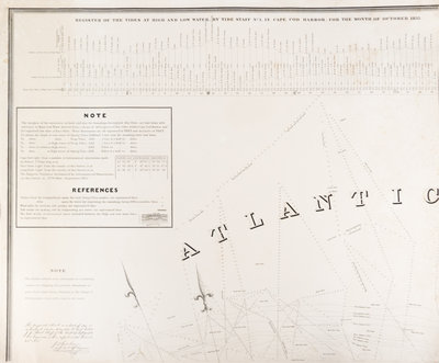
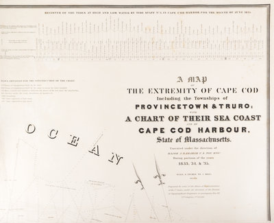
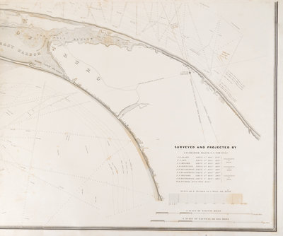
(MAP) UNITED STATES BUREAU OF TOPOGRAPHICAL ENGINEERS
A Map of The Extremity of Cape Cod Including the Townships of Provincetown, Truro: with A Chart of Their Sea Coast and of Cape Cod Harbour, State of Massachusetts. Executed under the Direction of Major J.D. Graham U.S. Top. Engr. During portions of the years 1833, '34 & 35. Washington, DC, 1836. Large four-sheet engraved map of Cape Cod based on surveys conducted by the Topographical Engineers in 1833-1835. Sheets not attached.
Sheets 32 x 37 inches each.