Condition Report
Contact Information
Lot 368
Lot Description
(Maps & Atlases : A...
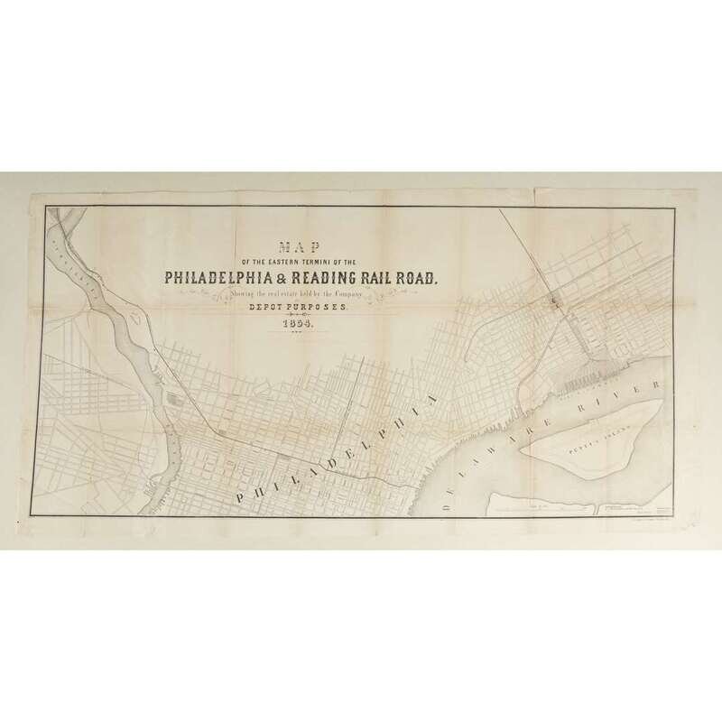
(Maps & Atlases : American Subjects : Railroads). 1 Piece. Lithographic Railroad Map. (Duval, P. S., lithographer.) "Map of the Eastern Termini of the Philadelphia & Reading Rail Road, Showing the real estate held by the Company for Depot Purposes. 1854." Philadelphia, 1854. 22 1/4 X 43 inches; 565 x 1,092 mm - sheet size, 20 1/4 x 40 1/2 inches; 515 x 1030 mm - neat lines. Tears and chips in blank margins, vertical creases along old folds, several separations (traversing as much as a half a fold) along old folds into the body of the map, other small tears in body - resulting in negligible paper loss, some offsetting and minor discoloration in body.
Uncommon large format, singly issued American anti-bellum railroad map. Likely the first railroad map to document the Port Richmond coal docks (complete with the depiction of the dock's 18 piers); also representing the main access lines of Philadelphia's most important "long haul" railroad lines, the Philadelphia & Columbia, and the P. & R. The importance of the Port Richmond coal docks, to which coal from the recently opened coal fields of upstate Pennsylvania was delivered by rail to be shipped to a national and international market, is central to the pre-Civil War economic development of the United States. One of only a small number of recorded large format pre-Civil War American railroad maps.