Condition Report
Contact Information
Lot 204A
Sale 4439 - The Pennsylvania Sale
Nov 10, 2015
5:00AM ET
null / Philadelphia
Own a similar item?
Estimate
$2,500 -
4,000
Lot Description
1 piece. 1 piece.
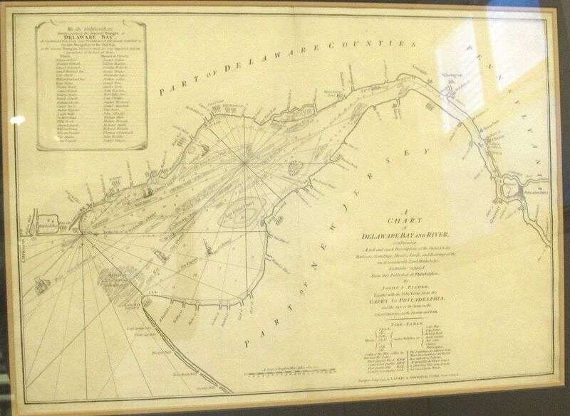
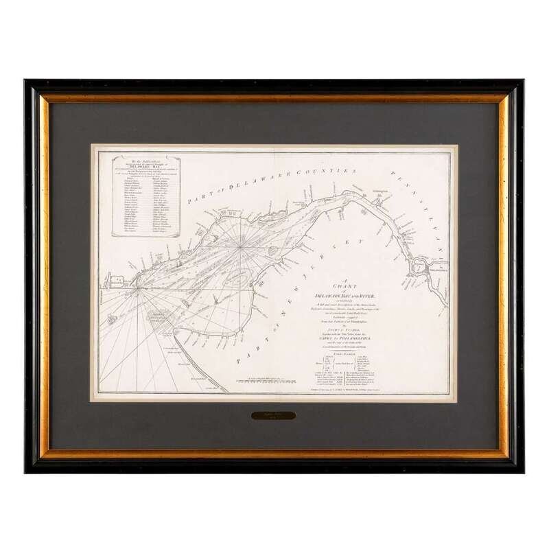
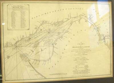
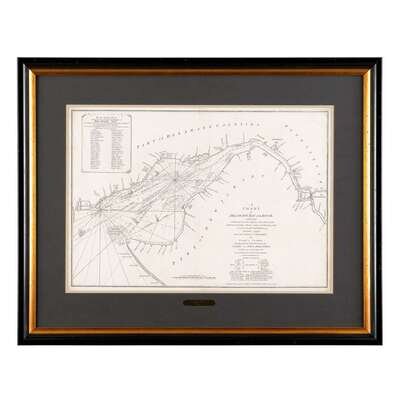
Fischer, Joshua. Engraved Map.
"A Chart of Delaware Bay and River." London: ptd by Laurie & Whittle, May 12, 1794. 20 x 28 3/4 in; 508 x 730 mm. Exceptionally clean. Light vertical center fold crease, not examined out of archival frame, mat covering margins. From Laurie & Whittle's North American Pilot, 1795.
At the time of the Revolution, Fischer's Chart (first published in 1756) was the primary source for navigation to Philadelphia.
Phillips, American Maps p263.
Provenance
Condition Report
Contact Information
Search