Condition Report
Contact Information
Lot 854
Sale 6216 - The Pennsylvania Sale
Nov 14, 2012
5:00AM ET
null / Philadelphia
Own a similar item?
Estimate
$2,000 -
3,000
Price Realized
$5,500
Sold prices are inclusive of Buyer’s Premium
Lot Description
1 piece. 1 piece.
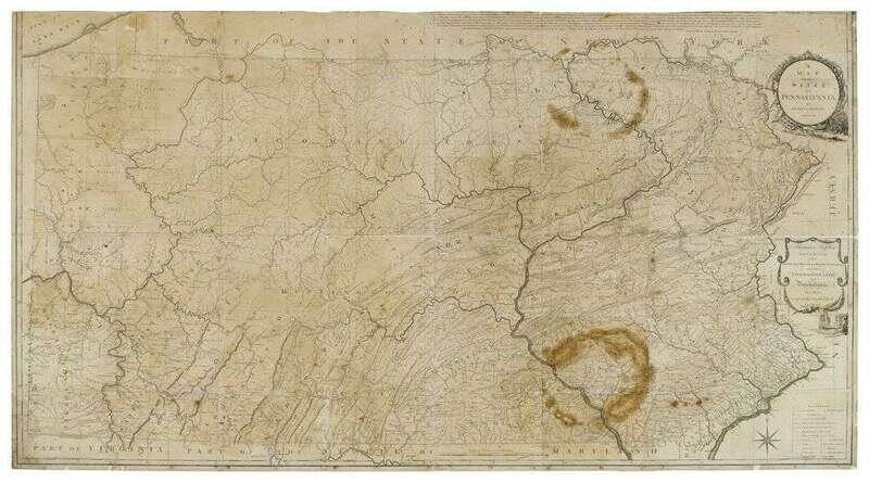
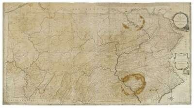
Engraved Map. "Howell Reading. "A Map of the State of Pennsylvania." London, August, 1792. Four sheets, 36 5/8 x 63 3/8 inches; 930 x 1610mm. Trimmed within plate mark, further trimmed at upper neat line, occasional minor chipping at edges, 2 horseshoe-shaped stains to Lancaster & Luzerne counties, other scattered small surface stains & minor abrasions. Mounted to modern bd.
"This is the best map of Pennsylvania to appear in the 18th-century, and the first detailed map to show the exact boundaries of the state" - Wheat & Brun. p. 92.
Wheat & Brun 435, i.e. state III.
Provenance
Condition Report
Contact Information
Search