
Condition Report
Contact Information
Auction Specialist
Lot 240
Sale 1314 - American Furniture, Folk & Decorative Arts
Mar 15, 2024
10:00AM ET
Live / Cincinnati
Own a similar item?
Estimate
$300 -
500
Price Realized
$286
Sold prices are inclusive of Buyer’s Premium
Lot Description
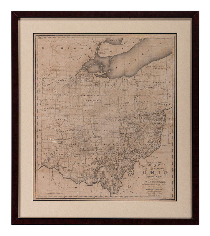
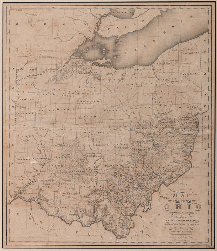
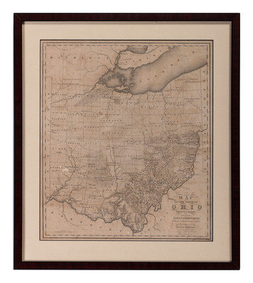
BOURNE, Alexander and KILBOURNE, John. Map of the State of Ohio Drawn by A. Bourne. Including the Indian Reservations, Purchased and laid out into Counties and Townships in 1820. Drawn by J. Kilbourne. Windsor, Connecticut, circa 1820.
Engraved map of Ohio, visible area 19 1/4 x 16 3/4 inches.
showing the absorption of Indian land in northwestern Ohio, along with the state's 70 counties, major roadways, rivers, vegetation, and important settlements, along with particularly clear topographical details.
from Caleb Atwater's Description of the Antiquities Discovered in the State of Ohio…, Volume I of the American Antiquarian Society's Archaeologia Americana, first published in 1820.
Property from the Robert and Nancy Treichler Collection of Ohio Stoneware and Americana, Tallmadge, Ohio