Condition Report
Contact Information
Lot 500
Sale 5046 - Fine Book Sale
Jan 25, 2007
5:00AM ET
null / Philadelphia
Own a similar item?
Estimate
$800 -
1,200
Price Realized
$2,500
Sold prices are inclusive of Buyer’s Premium
Lot Description
1 piece. 1 piece.
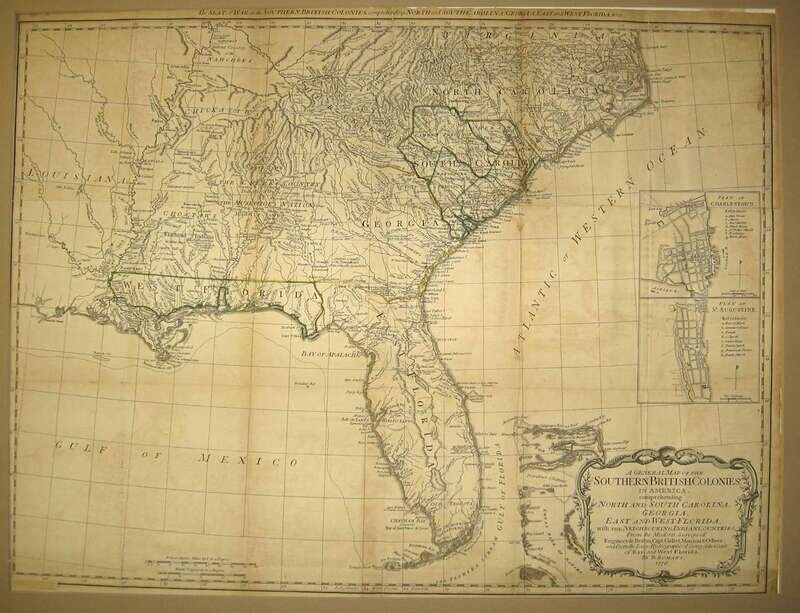
Engraved Map with Outline Color. Romans, Bernard. "A General Map of The Southern British Colonies in America... North and South Carolina, Georgia, East and West Florida,..." [London], 1776. 20 1/2x 26 1/8 inches; 520 x 660 mm, trimmed at platemark. Age toned, darkened at edges, a few repairs along folds on verso. Framed.
Prepared for The American Military Pocket Atlas issued by R. Sayer & J. Bennett; know as "The Holster Atlas" since it was made for the use of British cavalry officers engaged in the American Revolutionary War.
Provenance
Condition Report
Contact Information
Search