Condition Report
Contact Information
Lot 15
Sale 5046 - Fine Book Sale
Jan 25, 2007
5:00AM ET
null / Philadelphia
Own a similar item?
Estimate
$100 -
150
Price Realized
$110
Sold prices are inclusive of Buyer’s Premium
Lot Description
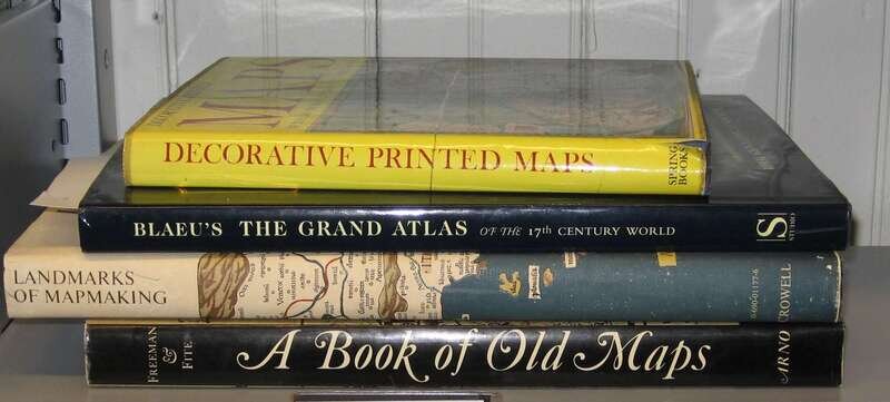
4 vols. 4 vols.
Cartography: Skelton R.A: Decorative Printed Maps of the 15th to 18th Centuries. London: Spring Books, (1966) 4to, orig. cloth; light wear, d/j (some creasing & repairs). Color & b/w plates. * Fite, Emerson D.; Freeman, Archibald. A Book of Old Maps. New York: Arno, 1969. Folio, orig. cloth, d/j. Plain plates. Minor wear. * Tooley, R.V., et al. Landmarks of Mapmaking. New York: T.Y. Crowell, (1976) 1st Am. ed. Folio, orig. two-tone cloth, d/j. Fold color plates, other illus. Minor wear. * Gross, John. Bleau's The Grand Atlas of the 17th Century World. London: Studio, 1997. Folio, orig. cloth, d/j. Color plates. Minor wear. All NF-\NF+
Provenance
Condition Report
Contact Information
Search