Condition Report
Contact Information
Lot 591
Sale 5524 - Fine Books & Ephemera
Jan 22, 2004
5:00AM ET
null / Philadelphia
Own a similar item?
Estimate
$2,000 -
3,000
Price Realized
$2,600
Sold prices are inclusive of Buyer’s Premium
Lot Description
1 piece. 1 piece.
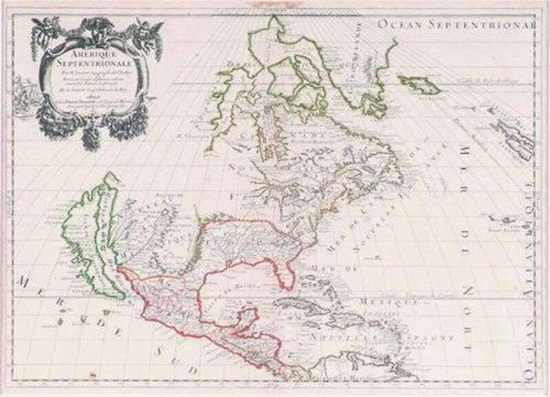
Hand-Colored Engraved Map. Sanson d'Abbeville, Nicolas. "Amerique Septentrionale." Paris: Pierre Mariette, 1669. 15 5/8 x 22 inches; 395 x 560 mm, margins. Small area of dampstaining in top center margin, small area of foxing on lower left, but generally bright & clean with contemp. color. Framed.
First published in 1650, Sanson's map remained the predominant map of North America for the rest of the 17th-century. The first printed map to show all five Great Lakes; first to name Lakes Superior (Lac Superieur) and Ontario; California is shown as an island and Santa Fe is erroneously located on the west bank of the Rio Grande.
Provenance
Condition Report
Contact Information
Search