
Condition Report
Contact Information
Lot 425
Sale 1097 - Fine Printed Books & Manuscripts, Including Americana
Lots 1-410
Nov 8, 2022
9:00AM CT
Lots 411-717
Nov 9, 2022
9:00AM CT
Live / Chicago
Own a similar item?
Estimate
$800 -
1,200
Price Realized
$1,000
Sold prices are inclusive of Buyer’s Premium
Lot Description
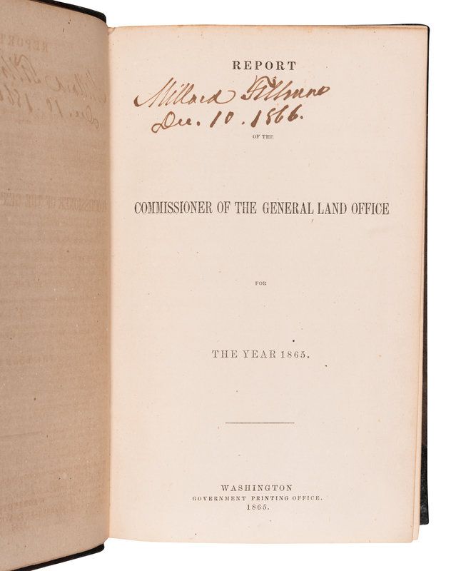
[FILLMORE, Millard (1800-1874), his copy]. Report of the Commissioner of the General Land Office for the Year 1865. Washington: Government Printing Office, 1865.
8vo (224 x 143mm). 15 (of 16) folding maps bound at end, some with hand-coloring. (Lacking one folding map, some maps with some minor spotting, some with splits or breaks at folds, some maps with small repairs or reinforcements.) Contemporary half morocco (joints and extremities restored).
MILLARD FILLMORE’S COPY, SIGNED TWICE: vertically in ink on front pastedown (“Millard Fillmore /Dec. 10 . 1866”), and on the title-page (“Millard Fillmore / Dec. 10. 1866”).
A rare report on the status of government-owned lands in the South and West at the end of the Civil War. The maps are extremely precise, with some geographic details plus full display of what areas had been surveyed and laid out. Includes a large general map of the west, plus individual maps of Arkansas, Alabama, Florida, Iowa and the Dakota Territory, Kansas and Nebraska, Louisiana, Missouri, Mississippi, Minnesota, Michigan, Illinois, Wisconsin and Minnesota, Oregon, and California and Nevada.
Property from the Patrick Atkinson Collection, Minneapolis, Minnesota